


Agricultural News
GEOSYS Provides New In-Season Precision Satellite Technology
Wed, 06 Jun 2012 10:16:22 CDT
Detailed, current satellite images now available to help farmers and retailers make crucial decisions
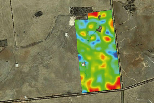
The latest satellite images of specific fields-combined with pertinent agronomic data-are now available to farmers and their retail partners to optimize the in-season decisions they make. The images are powered by new, exclusive technology from GEOSYS that arms retailers with the latest data to make decisions, such as determining appropriate crop protection and nutrient application, as focused and efficient as possible.
"This new, exclusive technology is really targeted at making every decision as profitable as possible for the farmer. Our technology helps retailers and agronomists better identify areas of a field that require immediate attention to protect yields for their farmers," says Norm Davy, senior vice president GEOSYS, Inc. "The remote field scouting tool uses the latest innovative GEOSYS technology to deliver these current satellite images throughout the growing season, and automatically distributes email alerts when new field images are added."
Available through a secure website, the up-to-date images can be converted into application maps using the most advanced agronomic models and geographic information systems to help farmers manage variations within their specific fields. During the 2012 crop year, the service is available exclusively through WinField Solutions.
"GEOSYS helps ag professionals around the world manage spatial and temporal variability within farmers' fields to optimize yields, profitability and sound environmental practices," says Davy.
WebReadyTM Powered by WireReady® NSI
Top Agricultural News
More Headlines...


