


Agricultural News
Drought Monitior Shows Exceptional Drought Area Grows Slightly Across Oklahoma
Thu, 17 Jan 2013 15:37:52 CST
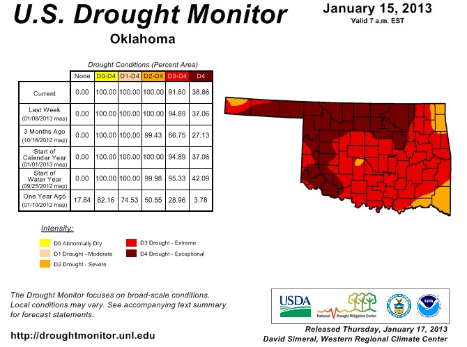 Exceptional Drought edged up in the latest Drought Monitor update- even as the southeastern part of the state showed some improvement. The new U.S. Drought Monitor map was an exercise in give-and-take this week. The improvement in southeastern Oklahoma was thanks to 4-7 inches of rain since the beginning of December. Idabel led the way with 7.3 inches in the gauge, and Broken Bow had 7.1 inches. The rest of the state had from about a half-inch to 2 inches.
The graphic above is the latest Drought Monitor for Oklahoma, as released on Thursday morning.
The Extreme (D3) area in the far southeast went to Severe (D2), but the D3 area up around Kay, Osage and Washington counties went to Exceptional (D4). So we saw a decrease in the amount of D3 from last week (from 58% to 53%), but an increase in the area of D4 (from 37% to 39%). And as has been the case for awhile now, the entire state is covered by Severe (D2) to Exceptional (D4) drought.
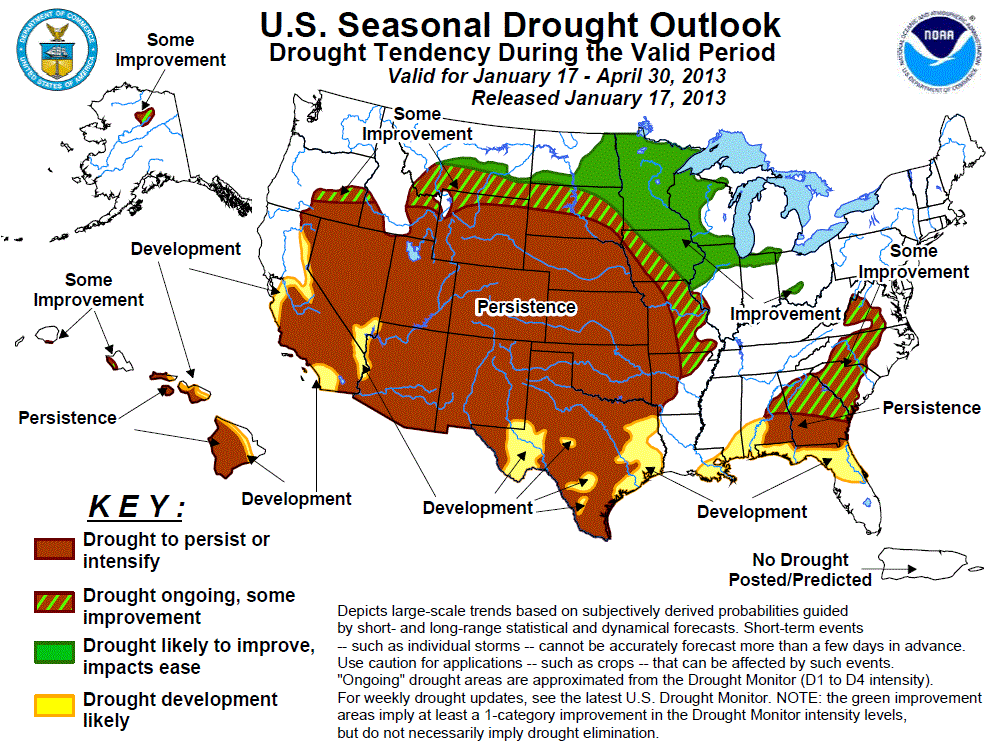
Below- we have the latest Drought Outlook map for the entire United States- and Oklahoma is painted a solid "brown" which means a prediction of slim to no chance of ending drought conditions well into April of this year. According to Assistant State Climatologist Gary McManus, "This map is effective for now through the end of April. Persistence or intensification is the call for all of Oklahoma, unfortunately."
Note that the entire Hard Red Winter Wheat belt lies within the brown that signifies a drought of persistence or intensification between now and mid April. The March-April time frame is when we absolutely need rain to help what wheat crop potential we still have be realized.
WebReadyTM Powered by WireReady® NSI
Top Agricultural News
More Headlines...


