


Agricultural News
Rainfall and More Piling Up Across the Thirsty Oklahoma Landscape
Thu, 21 Feb 2013 05:20:32 CST
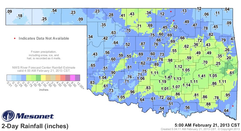 Thunderstorms, Thundersnow, Rainfall, Ice, Sleet, Snow and Blizzard conditions are all a part of the Thursday morning weather picture across the state. This is easily the most significant moisture event statewide since sometime last spring- and the graphic shown above is a snapshot as of 5:00 AM on Thursday morning, February 21, 2013.
Rain, sleet, ice and snow continue across Oklahoma this morning- so the totals will only go up- and in many cases- it may be a couple of days or longer before we know the full precipitation totals because the frozen stuff has to melt to be collected and counted by the Mesonet stations.
Byars and McAlester have both over 1.4 inches of the liquid stuff to this point.
Click here for the live rainfall total map as found on the Mesont- over a two day period.
Click here for live interactive radar from our Griffin Partner, News9, KWTV.
WebReadyTM Powered by WireReady® NSI
Top Agricultural News
More Headlines...


