


Agricultural News
Oklahoma Weekend Severe Weather Timeline Shown in Maps
Fri, 25 Apr 2014 05:57:02 CDT
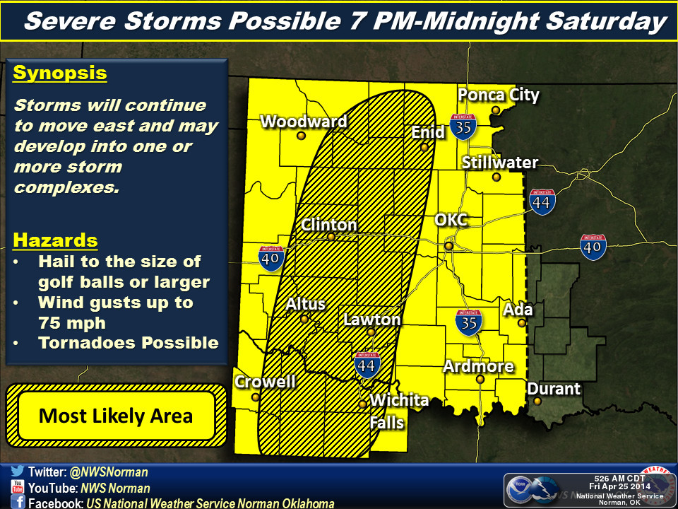
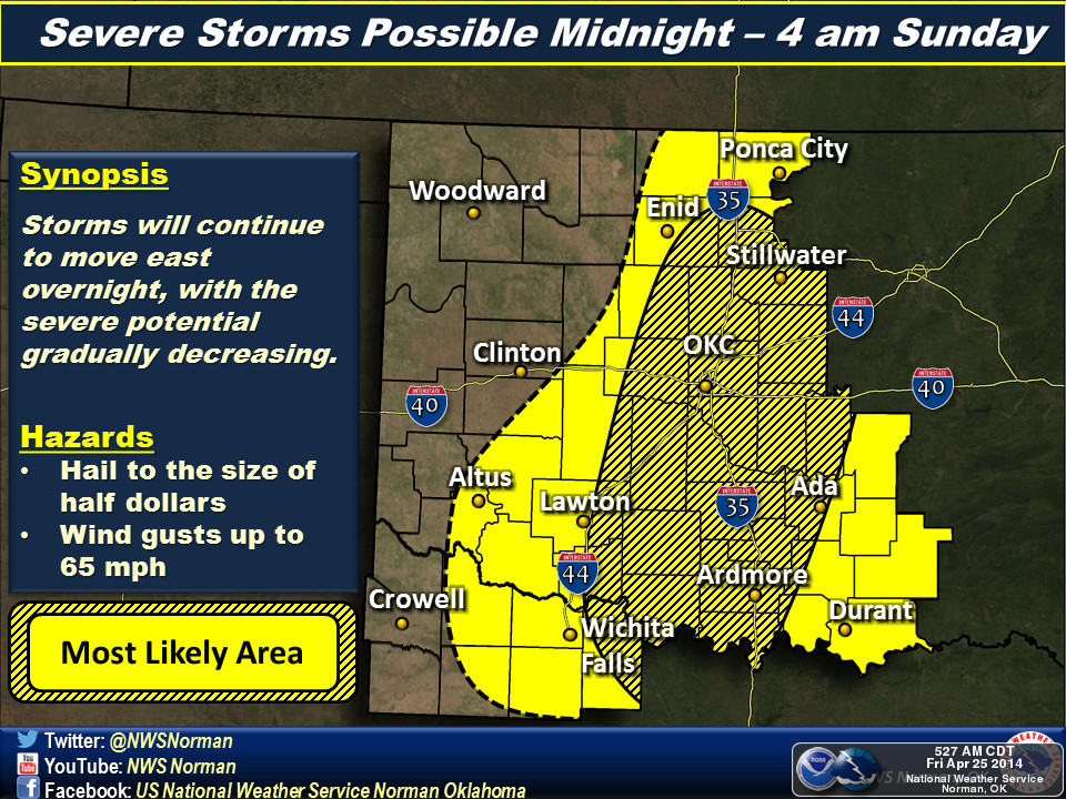
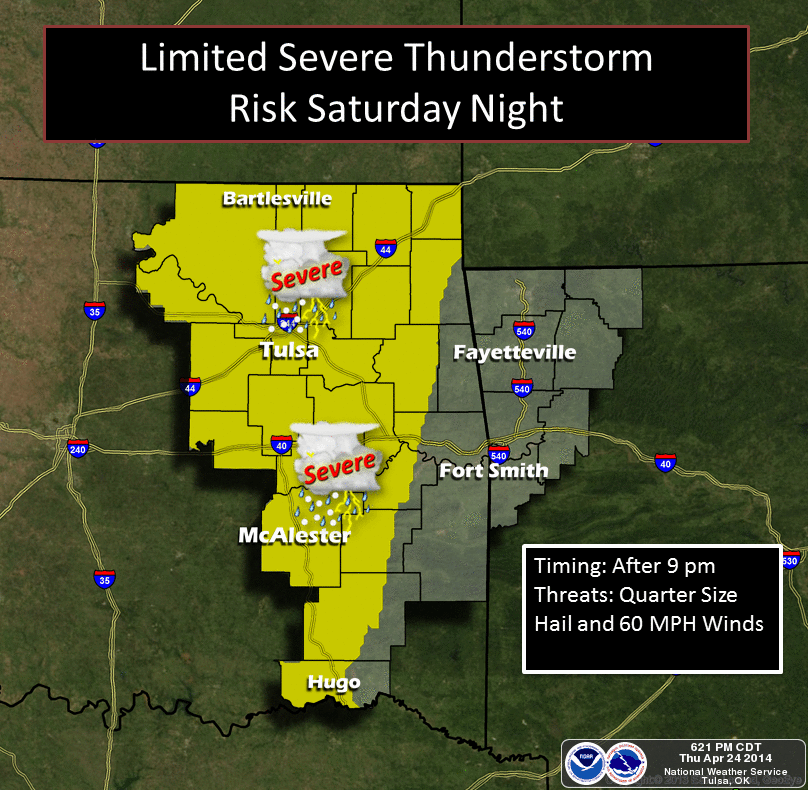
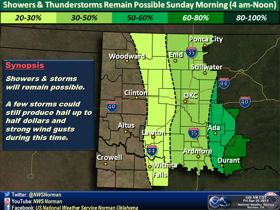
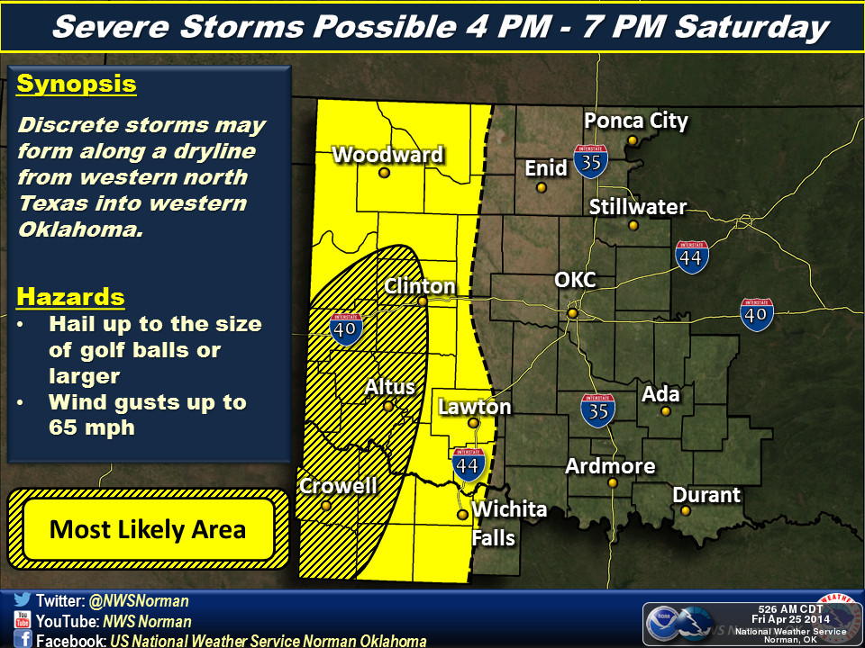 Severe weather may be in the cards for this weekend- and we have a series of maps courtesy of mostly the Norman National Weather Service office. We also have one map from the Tulsa NWS office which shows some threat of severe weather in eastern Oklahoma late Saturday night. The map above shows how things may be developing on Saturday afternoon and then the maps below offer a time line of the movement of this storm system.
Alan Crone with the News on 6 in Tulsa reports in his daily blog found in the Weather section of the News on 6 website that all of this severe weather really starts cranking in the Texas Panahandle and western Oklahoma Saturday afternoon. he writes "A layer of warm air aloft, the cap, will more than likely suppress thunderstorm activity until late Saturday afternoon and evening across the western third of the state. The atmosphere will become extremely unstable with convective and potential energy parameters increasing during the afternoon. A surface dry line should develop across the western third of the state with a surface low across either NW OK or southeastern Colorado. Late Saturday afternoon a subtle wave of instability will move across the high plains of Texas and cause a few storms to develop across southwestern or western OK. These storms would quickly become severe with damaging winds and very large hail. As the storms progress east and northeast by Saturday evening, conditions for rotating thunderstorms are expected to increase. This time period from late afternoon into the midnight to 2am hours may be the highest tornado potential for the western and central portion of the state.
"Most data now suggest the storms will continue to grow upscale into the early hours of Sunday and move from central OK into part of eastern OK. Despite the early morning arrival time, some of these storms would still be capable of severe weather.
"Showers and storms may move eastward Sunday morning across far eastern OK and eventually slowly weaken by late morning along the Ok-Ark state line area.
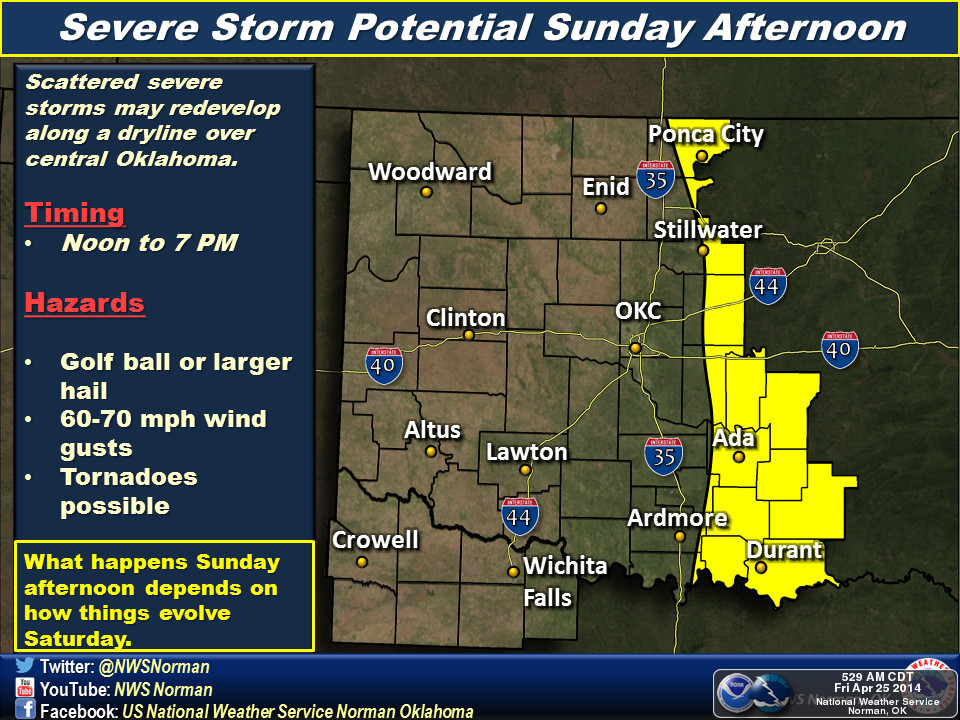
"Sunday mid-day to early afternoon, the dry line and cold front will begin moving eastward and additional thunderstorms are likely to develop near the highway 69-75 corridor southwest to the I-35 corridor of north TX. These would quickly develop into severe storms and then more rapidly northeast into far eastern OK and western Arkansas by late afternoon and evening. Conditions for very large hail, damaging winds, and some tornadoes would be possible across the eastern third of the state, with a more concentrated area of severe weather possible across far NE TX into SE OK, and SW Arkansas into extreme NE Louisiana."
To read his full blog on this Friday morning, click here.
WebReadyTM Powered by WireReady® NSI
Top Agricultural News
More Headlines...


