


Agricultural News
Gary McManus Says Tropical Storm Bill Will Bring Rainfall and Flooding to Oklahoma
Tue, 16 Jun 2015 16:24:54 CDT
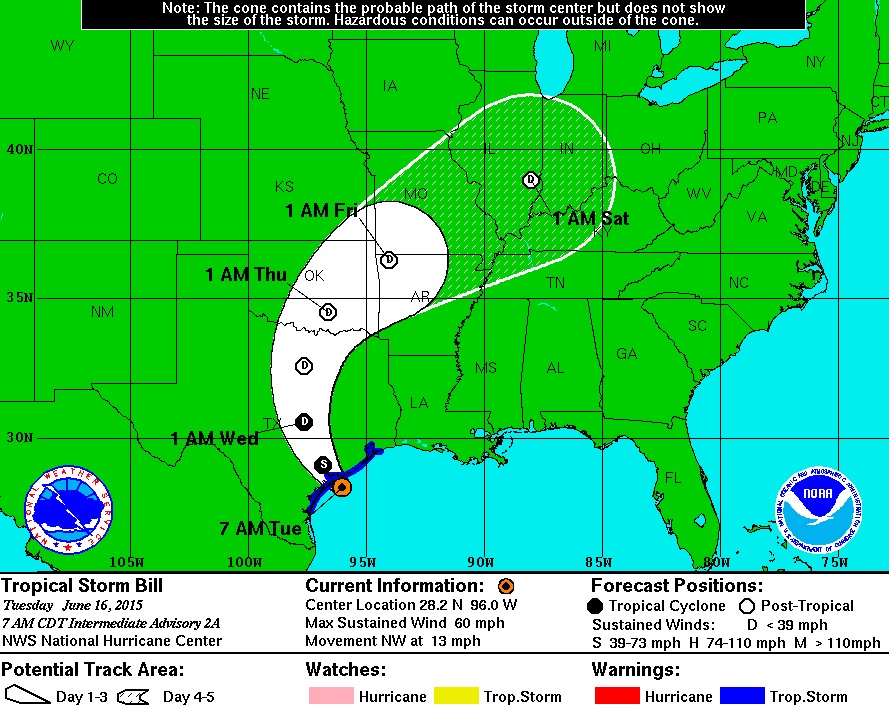
Tropical Storm Bill will be moving northeast out of Texas into Southeastern Oklahoma this week. The National Hurricane Center predicts the storm will track north, then northeast. State Climatologist Gary McManus said this storm have some of the characteristics to produce enough sheer for tornadoes and steady, intense rainfall. With these spiral bands, he said it is possible for areas to receive extreme rainfall totals exceeding ten inches. In the Oklahoma Climatological Survey Mesonet Ticker, he said much of the eastern two-thirds of the state remains under a flash flood watch in anticipation of Tropical Storm Bill's arrival and some areas remain under flood warnings.
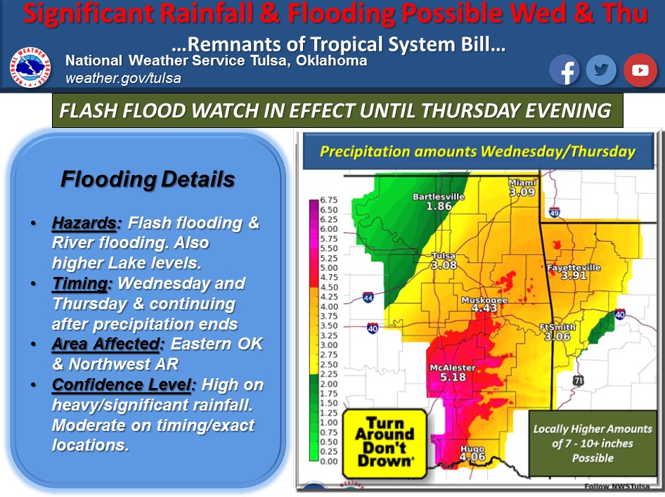
The National Weather Service in Tulsa forecasts the remains of tropical system Bill will track through Texas and into parts of Eastern Oklahoma and Northwest Arkansas Wednesday into Thursday. Rainfall amounts look to range from three to seven inches, with locally higher amounts of seven to ten inches and greater.
The heaviest amount of rainfall looks to be from Southeast Oklahoma through East Central Oklahoma into Northwest Arkansas. This will lead to flash flooding and main stem river flooding across the region. A flash flood watch remains in effect until Thursday evening for the region.
WebReadyTM Powered by WireReady® NSI
Top Agricultural News
More Headlines...


