

Agricultural News
Drought Monitor Numbers for Oklahoma Drop from 30% to 10% With Further Reductions Certain Next Week- The Latest Graphics
Thu, 21 Apr 2016 17:12:49 CDT
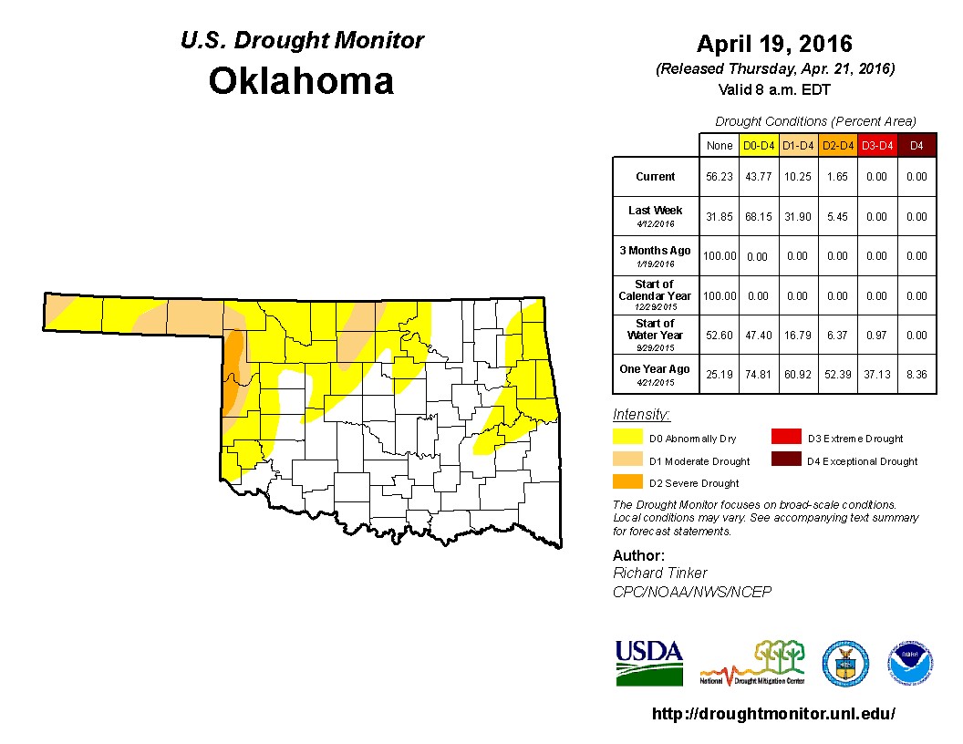 Oklahoma drought ratings were reduced in the latest weekly Drought Monitor updated released Thursday morning- but according to State Climatologist Gary McManus, it does not reflect any of the rainfall that rolled across the state after 7:00 AM on Tuesday morning. The graphic above shows a two thirds reduction in drought compared to a week ago. McManus writes in his latest Mesonet Ticker "So we went from 32% of the state in drought to 10%...that seems about right. The only increases were in western Roger Mills and Ellis counties, and also over in east central Oklahoma. Tiny increases, but as you can see from the 1-week change map, most of the area saw 1-2 class improvement.
"However, given that even more rain fell over the last two days, I think we will see more improvements next week (regardless of further rains). Speaking of further rains, we will have several storm systems making their way through the state over the next week to 10 days, bringing a chance of rain AND possibly severe weather.
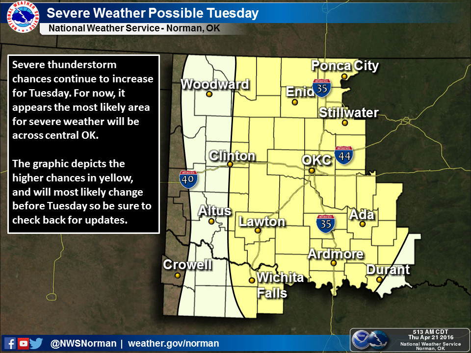
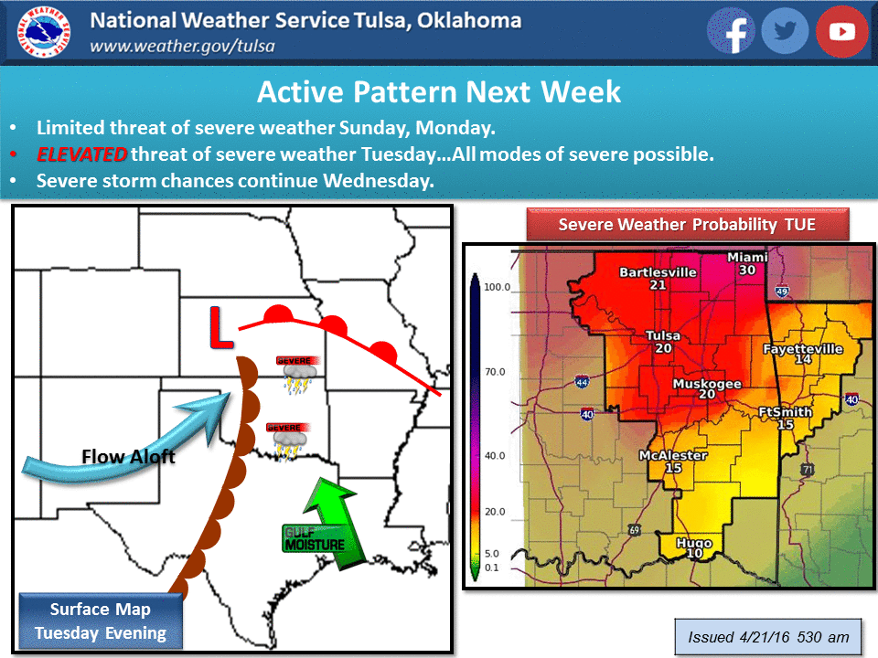
"The risk starts on Sunday, but the real risk begins on Tuesday. The forecast can and certainly will change a bit between now and Tuesday, but the chances are enough that the local NWS offices are talking about it already."
McManus quotes the Tulsa National Weather Service office as it relates to the severe weather that may lie ahead:
"A period of quiet weather will continue through Saturday...however this will change by Sunday as an upper wave slides across the plains bringing the potential for thunderstorms with a limited risk for severe weather. Another strong upper wave will take a track across the plains on Tuesday...and this system will bring the greatest potential for severe weather to the region...most likely during the afternoon and evening hours. Details will continue to be refined but it does appear a significant severe weather event may occur during this time frame. Now is a good time to review safety plans as the weather pattern will become rather active next week with multiple opportunities for severe weather."
The graphic below on the weather patterns that are ahead come courtesy of the Norman National Weather Service Office- they see much of the same danger ahead that is cited by Tulsa.
WebReadyTM Powered by WireReady® NSI
Top Agricultural News
More Headlines...


