

Agricultural News
Tropical Storm Cindy Heads for the Northeast with Her Rain in Tow, Weekend Cold Front Our Nearest Hope
Thu, 22 Jun 2017 14:57:57 CDT
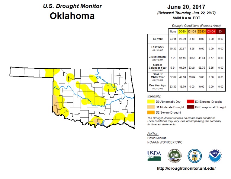 Oklahoma's State Climatologist Gary McManus issued his latest report on the Mesonet drought monitor this week. According to him, the residual moisture from Tropical Storm Cindy has bypassed our state so far, leaving flash drought conditions to accelerate, while rainfall deficits throughout the region continue to grow.
While Cindy takes a turn towards the Northeast, Oklahoma's best chance for precipitation lies with a fairly stout cold front blowing in from the Northern Plains this week.
Unfortunately, the forecast remains somewhat uncertain at this time. Still, Oklahoma's Southwest corner is currently the region with the most need for moisture, while the central part of the state comes in a close second.
Click here to take a look at the drought monitor on the Mesonet website.
WebReadyTM Powered by WireReady® NSI
Top Agricultural News
More Headlines...


