

Agricultural News
Drought Returns to OK for the first time since March 12th, According to the Latest Drought Monitor
Thu, 01 Aug 2019 11:59:54 CDT
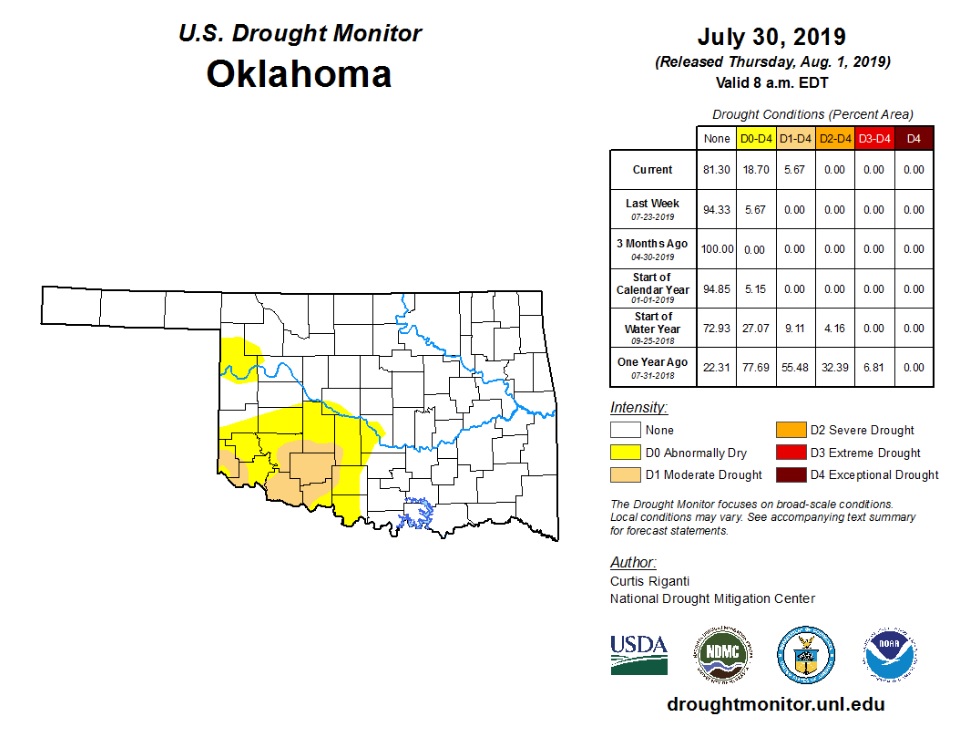 Drought has returned to the state for the first time since March 12, according to the latest Drought Monitor. The abrupt end of the moisture actually extended back to mid-June in some areas, while deficits widened further during July. Oklahoma State Climatologist Gary McManus reports the lack of rain coincided with intermittent periods of hot, windy weather which helped accelerate the drought development process despite the month being cooler than normal overall.
According to preliminary data from the Oklahoma Mesonet, the statewide average rainfall total was 1.63 inches, 1.25 inches below normal, to rank as the 29th driest July since records began in 1895.
Nearly 6% of the state was in moderate drought according to the July 30 U.S. Drought Monitor report, and another 13% was considered "abnormally dry," a drought precursor. Those designations cover most of the southwestern quarter of the state, with another area centered over Ellis County in the northwest. Drought development is considered likely across the western two-thirds of the state through the end of August according to the Climate Prediction Center's (CPC) monthly drought outlook. That drought development would be in addition to those areas that saw drought advance by the end of July.
Click here for a closer look at this week's Drought Monitor, or to review the latest comments from State Climatologist Gary McManus is the Mesonet Ticker report, click here.
WebReadyTM Powered by WireReady® NSI
Top Agricultural News
More Headlines...


