

Agricultural News
Last Week's Rains Prove No Match for Drought as Dryness Continues to Spread Across Oklahoma
Thu, 15 Aug 2019 14:29:54 CDT
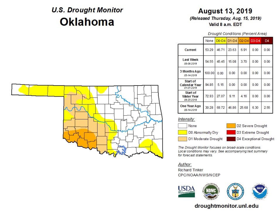 Moisture from last week's rains were unfortunately not enough to slow the growing momentum that continues to intensify the current flash drought situation that much of Oklahoma has found itself in after months of being drought-free. State Climatologist Gary McManus reports this week that while some areas improved where rain fell heaviest across the state, other areas have fallen victim to the drought cycle causing what moisture they did receive to quickly evaporate and allow the drought's effects to progress.
In the current map for this week you can see the change since last week with the last 30 days being key, although deficits are starting to bulge even over the last 60 days. With coverage (D1-D4) at 23.63%, there actually has not been this much drought extent since Sept. 4, 2018. McManus says that frankly, this is in fact only a minor blip on the drought radar over the last 10 years.
Prospects for curtailing the current dry spell do not look great as of now. Expect to continue to see rain chances around the periphery of the heat dome, and maybe a few incursions farther into the state. However, there is at this point no major precipitation events being forecasted on the horizon - only more heat.
For a closer look at this week's Drought Monitor Map, click here, or to review McManus' latest report on the Mesonet Ticker, click here.
WebReadyTM Powered by WireReady® NSI
Top Agricultural News
More Headlines...


