

Agricultural News
Latest Drought Monitor Map Shows All But Cimarron County Drought Free
Thu, 19 Mar 2020 15:35:57 CDT
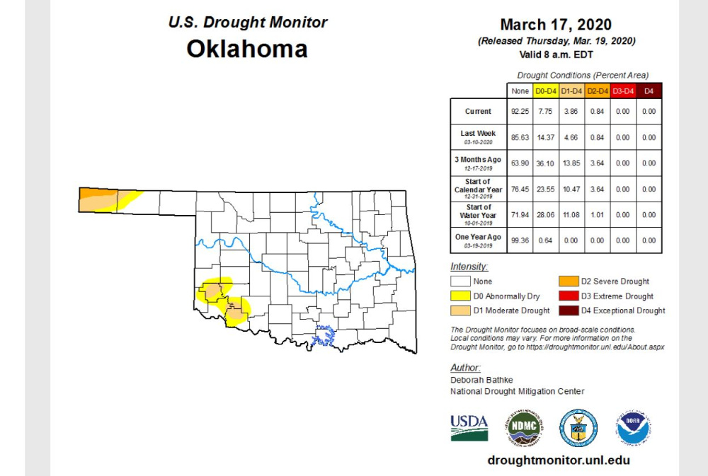
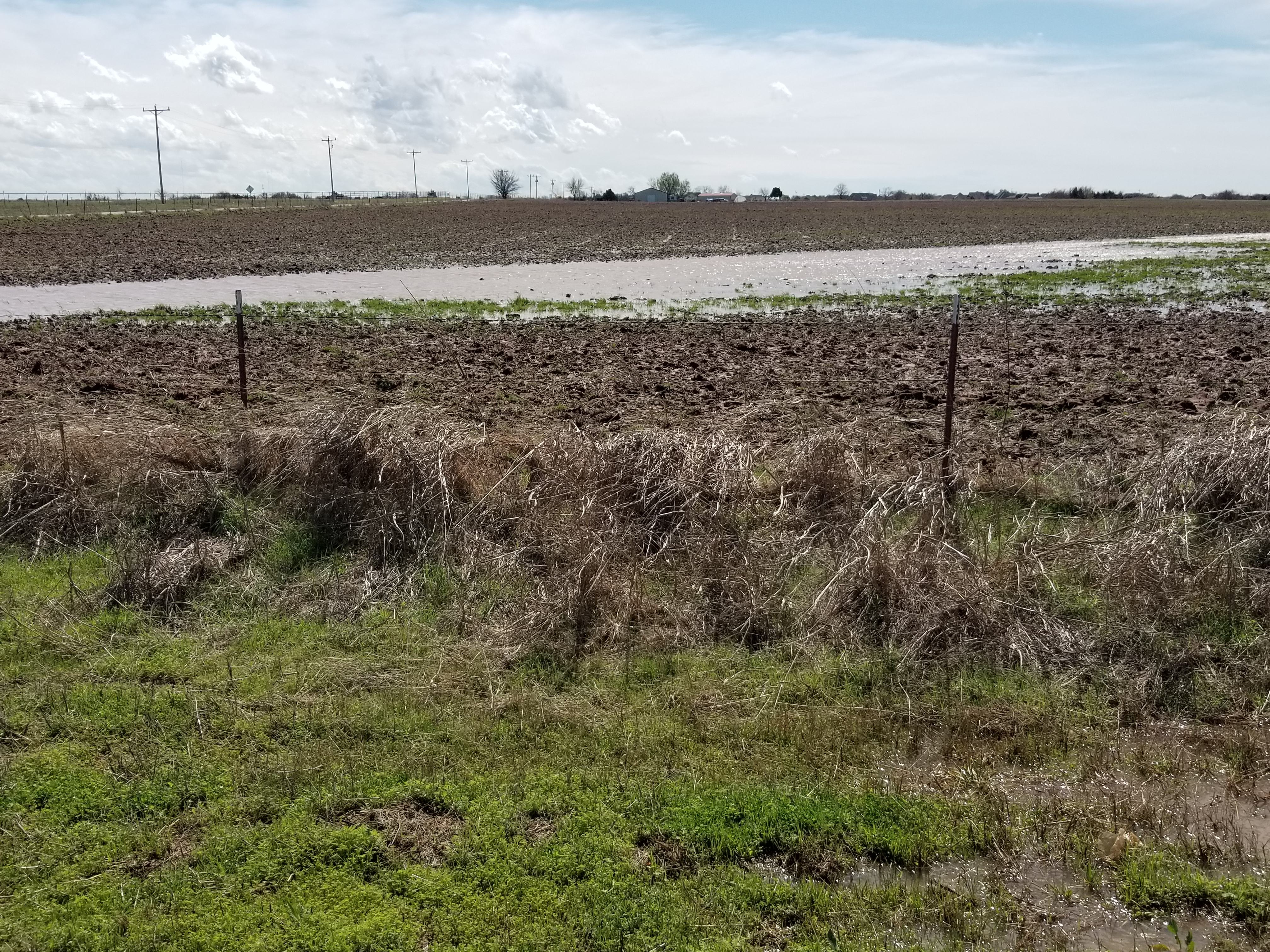 Taking a look a the latest drought monitor map released March 19 still shows a small section of the far western Oklahoma Panhandle continuing to need a good drink of water. The dry areas in southwest Oklahoma that we have been watching were basically washed away in the March 18 storms (see photo of flooded field in west central Oklahoma after March 18 storm) but won't be reflected in the map until next week.
Today the worse drought in Oklahoma is D2- Severe Drought and it currently is found only in the northwestern tip of Cimarron County and accounts for less than one percent of the state's total land area, the same percentage as last week.
The map shows those pockets of moderate drought and abnormally dry in southwest Oklahoma now at 11.6 percent, down from 19 percent last week. Interestingly, three months ago these two categories accounted for almost 50 percent of the state's landmass.
The U.S. Drought Monitor Map is developed through a partnership between the National Drought Mitigation Center at the University of Nebraska-Lincoln, the United States Department of Agriculture, and the National Oceanic and Atmospheric Administration.
To study current drought ratings in further depth for the state- click or tap here.
https://droughtmonitor.unl.edu/CurrentMap/StateDroughtMonitor.aspx?OK
WebReadyTM Powered by WireReady® NSI
Top Agricultural News
More Headlines...


