

Agricultural News
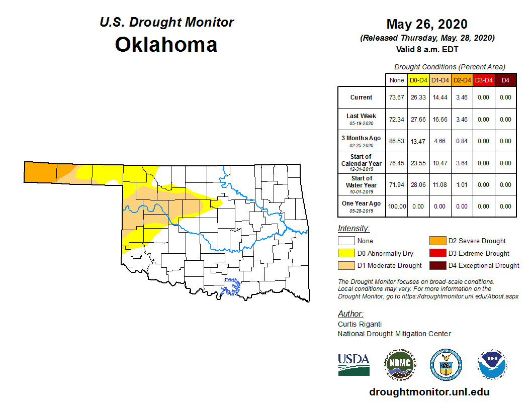
Latest Drought Monitor Map Shows Some Drought Conditions Eased But Oklahoma Panhandle Remains High and Dry
Thu, 28 May 2020 15:29:57 CDT
 During the past week, widespread precipitation across many areas of the High Plains eased drought conditions, especially in parts of western Oklahoma, central and northern Texas.
However, rainfall again failed to hit the western Oklahoma Panhandle, where severe drought has persisted much of the year.
Despite the ongoing precipitation deficit, we have yet to see any of the dreaded red (D3 Extreme) or dark red (D4 Exceptional) shades show up in Oklahoma this year.
Moderate drought increased in eastern New Mexico, but recent precipitation has helped reduce extreme drought in part of eastern Colorado.
The Oklahoma map overall shows little change from last week, with the severe drought or worse category covering about 14.4 percent of the state this week, compared to 16.6 percent last week. Almost 74 percent of the state is experiencing no drought conditions this week.
We continue to see a slow eastern expansion of abnormally dry conditions into central Oklahoma, moving across Kingfisher and Logan counties and reaching just into Payne County.
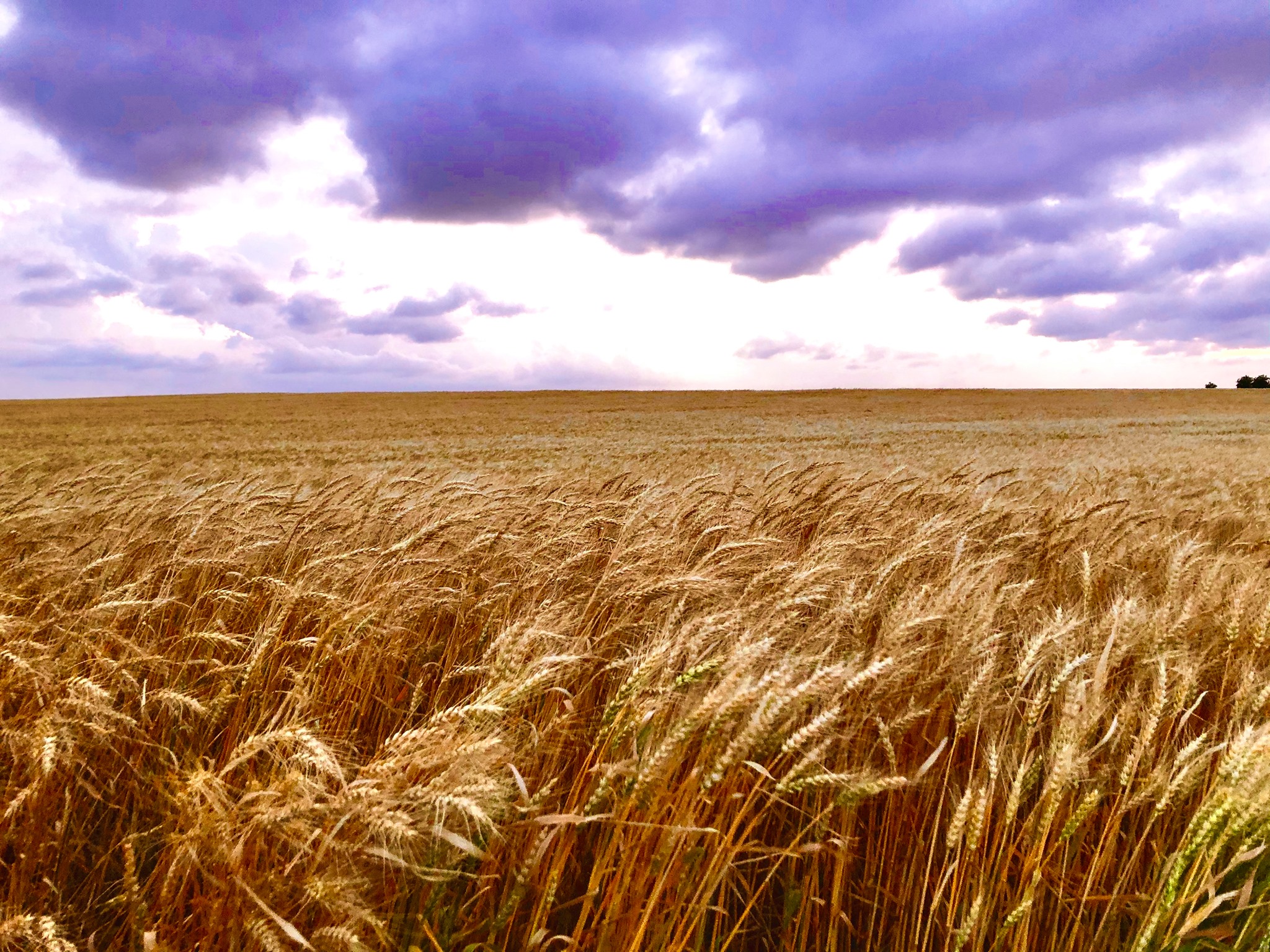
Wheat producers will enjoy the harvest forecast for its lack of rain and abundance of sunshine. They will also hate the forecast for the same reasons. As soon as the dry fields are harvested, drought conditions will spread across the once golden plains.
According to the U.S. Drought Monitor's definition of severe drought, dryland crops are severely reduced and pasture growth is stunted and cattle are stressed. If the D3 Extreme Drought expands, we could see pastures go dormant and the danger of wildfires goes up.
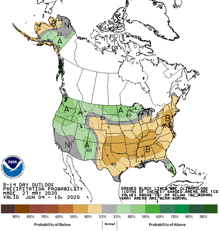
The latest near term outlook forecast shows warm, dry conditions are expected to settle in to kick off the summer. The National Weather Service Climate Prediction Center is forecasting a high probability of warmer than normal temperatures and below normal rain centered on the central Great Plains.
To view the NOAA precipitation outlook, click here.
To view the Oklahoma drought map, click here.
To view the U.S. drought monitor map, click here.
The U.S. Drought Monitor Map is developed through a partnership between the National Drought Mitigation Center at the University of Nebraska-Lincoln, the United States Department of Agriculture, and the National Oceanic and Atmospheric Administration.
WebReadyTM Powered by WireReady® NSI
Top Agricultural News
More Headlines...


