

Agricultural News
Extreme Drought Areas Edging Closer To Oklahoma
Thu, 07 May 2020 15:16:43 CDT
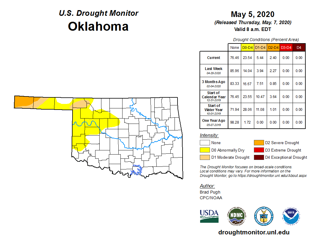 Extreme drought (D3) is starting to edge ever so closely to Oklahoma on the latest U.S. Drought Monitor map.
There are currently areas of D3 in southern and southeast Colorado and southwest Kansas. These areas are surrounded by large swaths of severe and moderate drought as well as abnormally dry. The abnormally dry area now extends as far east as the western edge of Logan County and south to Harmon County.
Almost 24 percent of Oklahoma is covered in the yellow shaded abnormally dry compared to just 14 percent last week. We have now reached the same percentage of dryness dating to Jan. 1, so it's been a dry year so far for much of western and northwestern Oklahoma.
According to the definition of severe drought, which covers most of Cimarron and parts of Texas County, dryland crops are severely reduced and pasture growth is stunted and cattle are stressed. If the D3 Extreme Drought expands, we could see pastures go dormant and the danger of wildfires goes up.
The reason for the expanded drought regions is due to increasing 30 to 60-day precipitation deficits, above normal temperatures and periods of strong winds.
Precipitation deficits are even more dramatic to our west and north. Areas of southwest Kansas have deficits ranging from 2 to 4 inches in the past 60 days.
Overall, this dryness accounts for part of the reduced winter wheat yield estimates released this week.
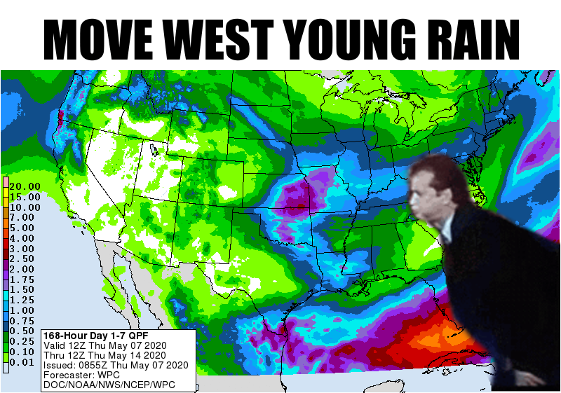
The 7-day forecast will help push some of the dry areas west but not much, as shown in this humorous graphic from our friends at the Oklahoma Mesonet Ticker.
Click here for the forecast map.
Click here for this week's Oklahoma drought monitor map.
Click here for this week's U.S. Drought Monitor map.
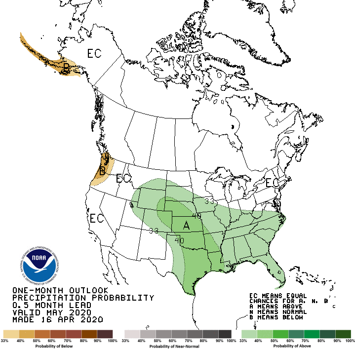
Click here for the Climate Prediction Center map for May precipitation.
The U.S. Drought Monitor Map is developed through a partnership between the National Drought Mitigation Center at the University of Nebraska-Lincoln, the United States Department of Agriculture, and the National Oceanic and Atmospheric Administration.
WebReadyTM Powered by WireReady® NSI
Top Agricultural News
More Headlines...


