

Agricultural News
Latest Fire Situation Report Shows Fire Danger Concerns Across the State
Tue, 16 Jun 2020 10:02:52 CDT
 According to the Latest Oklahoma Fire Situation report for June 16th Shows A Red Flag Warning is in effect today from 11:00 AM through 7:00 PM in Cimarron County.
FIRE DEPARTMENT STATISTICS from www.firereporting.ok.gov recorded on 06/12/2020 thru 06/16/2020
· 8 Fires Burned 489 Acres
· Additional Wildfire Activity Noted through informal reporting and media outlets.
· 180/Kiowa Rd Fire (Woods County) 550 Acres, 100% Contained
Statewide Discussion: A Red Flag Warning is in effect today from 11:00 AM through 7:00 PM in Cimarron County.
Fire danger concerns remain in place in place across much of Oklahoma with warm and breezy conditions. Atmospheric
moisture is forecasted to gradually increase and may spur some isolated, although light, rain showers. Isolated storm chances
build in late week. Along with those storm chances, lightning-ignited fires will again become a concern given the current
composite fuel moisture values.
Today: Some rain chances will be present in Oklahoma today although the best chance of wetting rains resides in south-central
and southeastern Oklahoma while fire danger concerns continue in the western half of the state. The highest fire danger
concerns today will develop in the Panhandle with a Red Flag Waring in effect for Cimarron County. Afternoon relative humidity
values across the western counties is not forecasted to be as low as previous days with some gulf moisture edging up which
is expected to provide firefighters improved opportunity containing the going fires. There is some opportunity for some isolated
rainfall in central and portions of western Oklahoma during peak heating today, but those chances do not hold much promise
of wetting amounts and will diminish with sunset.
· Oklahoma Panhandle: Again, a Red Flag Warning is in effect for Cimarron County from 11:00 AM through 7:00 PM
with elevated fire weather across the Panhandle. In the warned area, temperatures will warm into the mid-90?'s with
afternoon relative humidity values 13-17% under clear skies will prompt very receptive fine-dead fuel moisture values
of 3-4%. Given the separation from wetting rains in excess of 170 days, fuels are considered dormant and fully
available. South-southwest winds sustained 20-25 mph with some gusts this afternoon in excess of 30 mph will drive
potential for rapid rates of fire spread around 145 ft./min. with flame lengths 9 ft. in dominate grass fuels and rates of
spread nearer 220 ft./min. with flame lengths 12 ft. in areas where no grazing has occurred.
· Western/ West-Central Oklahoma: Afternoon relative humidity values are not expected to be as low as days previous
with some atmospheric moisture improvement and opportunity for widely scattered, light rain showers. Temperatures
this afternoon 90?-95? and relative humidity values 25-34% under some sky cover will yield fine-dead fuel moisture
values of 5-6%. South winds sustained 8-16 mph with some gusts in the afternoon 18-25 mph. Live-fuel moisture will
continue to mute rates of fire spread with 90-140 ft./min. average and head fire flame lengths 8-10 ft. Problematic fire
behavior should be expected in brush dominated fuels including singe and group tree torching.
· Central/Eastern Oklahoma: Improved relative humidity values and some expectation of scattered rain showers will
provide opportunity for good probability of initial attack success today. Temperatures will be low-90?'s with afternoon
relative humidity values 30-40%. Light south to southeast winds will limit rates of fire spread.
Short-term Outlook: Tomorrow will present another day of increased fire danger concern with focus remaining on the
Panhandle and northwestern counties. Thunder storm chances will increase later into the week with new fire occurrence
related to lighting probable. The current 7-day Quantitative Precipitation Forecast does hold some promise of moisture in areas
where it is sorely needed.
Resources: Duty Officer (800) 800-2481
· OFS has 2 Task Forces currently assigned to the Reno Rd. Fire (Canadian County) and Cedar Canyon Fire (Custer
County).
· OHP/OFS aerial reconnaissance
· ONG 1 Helicopter
· OEM in support
Note: OFS/ODAFF has personnel mobilized in support of ESF-8 Public Health
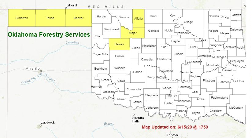
Burn Bans: Cimarron,
PROTECTION AREA STATISTICS 06/12/2020 thru 06/16/2020
NE Area 1 Fire Burned 6 Acres (1-Escaped Debris)
EC Area No New Activity
SE Area 6 Fires Burned 437 Acres (Cause: 4-Incendiary, 1-Escaped Debris)
Large / Significant Fire Activity within the Protection Area:
· Devils Backbone Fire (***) 420 Acres, 50% Contained
Fire Activity with OFS Response outside of the Protection Area: (7 Fires Burned 8,561.5 Acres)
· Reno Road Fore (Canadian County) 751 acres (est.), 5% Contained
· Cedar Canyon Fire (Custer County) 200 acres, 5% Contained
· Jeffery Ranch Fire (Dewey County) 463 acres, 50% Contained
· Sheep Fire (Major County) 319 Acres, 100% Contained
· Yolo Ranch Fire (Major County) 6.042 Acres, 80% Containted
WebReadyTM Powered by WireReady® NSI
Top Agricultural News
More Headlines...


