

Agricultural News
Both U.S. And Oklahoma Drought Maps Remain Basically Unchanged As Wet Weather Moved In After Map Deadline
Thu, 10 Sep 2020 14:52:37 CDT
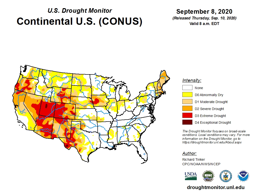
 Unusually cold and wet conditions replaced intense hot, dry conditions for much of the western half of the country during the past few days, yet the map looks similar to last week as the dramatic weather shifts occurred at the drought monitor reporting deadline.
A number of reporting sites from the central Rockies to the High Plains saw temperatures plunge from 90 degrees F on Labor Day to near freezing with snow by Tuesday morning.
The large area of Extreme Drought (D3) covers parts of northern California, southern and central Oregon, eastern Nevada, almost the entire state of Utah, western, central and southern Colorado and parts of several other neighboring states.
We continue to see that one area of D3 covering western Iowa and eastern Nebraska.
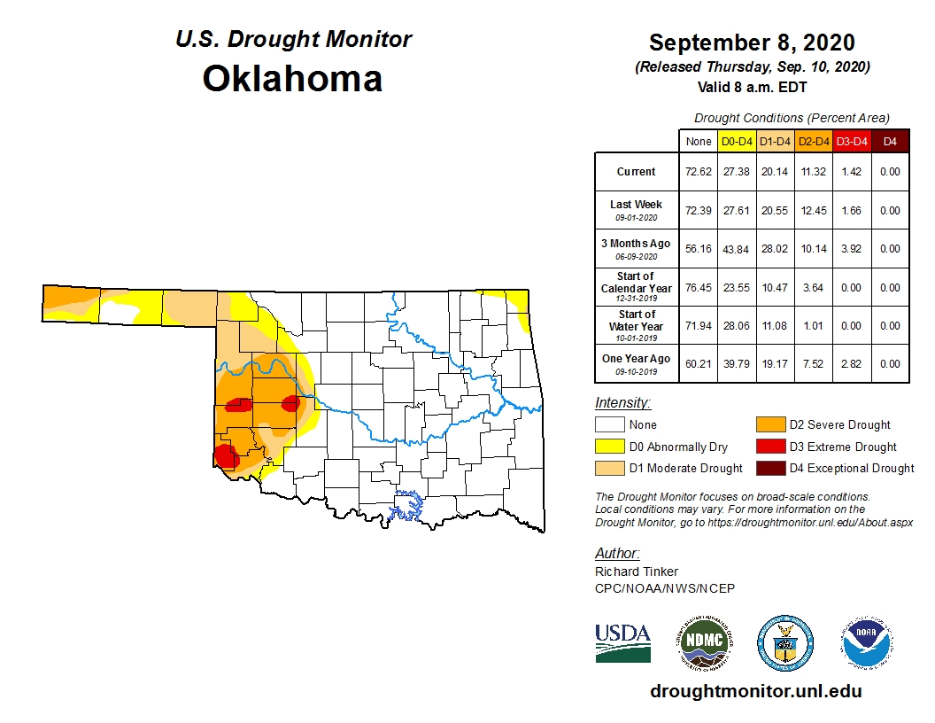
The Oklahoma map also remains virtually unchanged from last week because again the cool, wet weather occurred at map deadline.
There are several notes of optimism continuing from last week's map. More than 72 percent of Oklahoma's landmass is not experiencing any drought conditions.
We expect that number to dramatically go up on next week's map.
Even without the Tuesday storms, the amount of D3 Extreme Drought decreased slightly.
Both the temperature and precipitation forecasts for the next 10 days hold promise for improvements over much of the state.
Click here for the Oklahoma Drought Monitor map.
Click here for the U.S. Drought Monitor map.
Click here to view the 6-10-day temperature outlook.
Click here to view the 6-10-day precipitation outlook.
The U.S. Drought Monitor Map is developed through a partnership between the National Drought Mitigation Center at the University of Nebraska-Lincoln, the United States Department of Agriculture, and the National Oceanic and Atmospheric Administration.
WebReadyTM Powered by WireReady® NSI
Top Agricultural News
More Headlines...


