

Agricultural News
Drought Conditions Improve For Oklahoma As The Nation Focuses On Western Wildfires
Thu, 17 Sep 2020 15:45:23 CDT
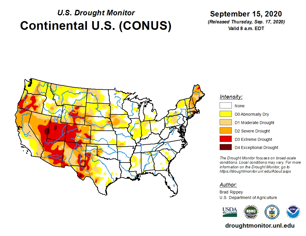
 Attention continues to be focused on the western half of the country in this week's Drought Monitor update.
Dry weather dominated California, Oregon and Washington as well as the northern Rockies, leading to extensive drought intensification as wildfires continued to burn hundreds of thousands of acres.
For the mid-section of the country, aggressive improvements were introduced in the hardest-hit areas, which extended northward into Oklahoma.
The good news for Iowa this week is rains erased the last vestiges off Extreme Drought (D3) from the west and central areas of the state.
Click here to view the U.S. Drought Monitor Map.
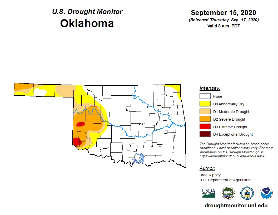
Specifically, for Oklahoma, not much has changed this week as 73.6 percent of the state is free of dry or drought conditions. (last week it was 72.6 percent).
There are still two small pockets of Extreme Drought (D3) in southwest Oklahoma but even those have been slightly improved.
Click here for the Oklahoma drought monitor map.
https://droughtmonitor.unl.edu/data/jpg/20200915/20200915_OK_text.jpg
There is some talk about a La Nina weather pattern setting up this winter. Our friends at the Oklahoma Mesonet summarized it this way:
-- La Nina conditions are present and expected to continue through the winter
of 2020-21 into early spring.
-- Current forecasts point to a MODERATE La Nina event.
-- Odds will be tilted towards a DRIER climate for the November-March period
across Oklahoma.
-- Snowfall could be diminished across northwestern Oklahoma.
-- Severe weather events could be more frequent across central and eastern
Oklahoma.
The Mesonet staff are quick to point out that ENSO (El Nino or La Nina...or even Neutral Conditions) is only one factor, but as climate factors go, it's one of the more easily predictable.
Other factors that can impact our winter climate and weather include the Arctic Oscillation and the North Atlantic Oscillation, which can influence the number of arctic air masses
that penetrate deep into the U.S. and are very difficult to forecast more than
a week or two in advance.
Cool and dry conditions are expected to dominate the Oklahoma weather scene during the next week.
Click here for the 6-10-day temperature outlook.
https://www.cpc.ncep.noaa.gov/products/predictions/610day/610temp.new.gif
Click here for the 6-10-day precipitation outlook.
The U.S. Drought Monitor Map is developed through a partnership between the National Drought Mitigation Center at the University of Nebraska-Lincoln, the United States Department of Agriculture, and the National Oceanic and Atmospheric Administration.
WebReadyTM Powered by WireReady® NSI
Top Agricultural News
More Headlines...


