

Agricultural News
Latest Drought Monitor Map Shows Unseasonal Winter Moisture Brings Some Drought Relief to High Plains
Fri, 30 Oct 2020 09:28:35 CDT
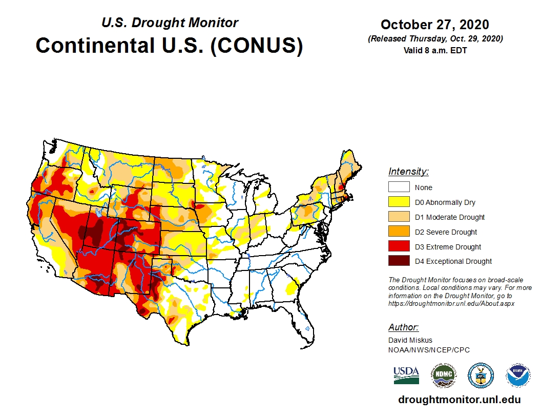
 Extremely frigid and unseasonably cold air with freezing precipitation moved across much of the country, easing some drought concerns according to the latest U.S. Drought Monitor map.
With freezing temperatures and precipitation extending from western Texas through Oklahoma into southern Kansas leading to moisture accumulations of 1-4 inches, we saw at least a one or two category improvement in drought ratings.
This is great news for winter wheat farmers who were growing increasingly concerned about the young crop's existence. Those who waited on moisture to plant remaining acres can now get back in the fields with renewed optimism once the ground is dry enough.
Unfortunately, southern and eastern Texas missed out on the fun and they saw drought conditions expand.
Late Tuesday was the cutoff for updating the maps so we can expect the next week's map to show even more improvement.
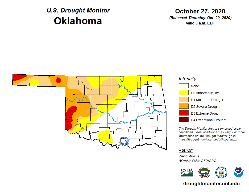
Even with the Tuesday deadline, enough precipitation had fallen in Oklahoma to knock about 10 points off the percentage of the state covered in drought.
To view the latest U.S. drought map, click here.
Even with the Tuesday deadline, enough precipitation had fallen in Oklahoma to knock about 10 points off the percentage of the state covered in drought.
There are still some red shades of Extreme Drought (D3) in the Panhandle and southwestern Oklahoma with lighter shades of Severe to Abnormally Dry ratings weeping up across the state.
We expect that map to change drastically next week.
To view the Oklahoma drought map, click here.
Looking ahead, there is dryer, warmer weather on the forecast maps.
To view the 6-10-day temperature outlook, click here.
To view the 6-10-day precipitation outlook, click here.
Keep in mind La Nina has arrived and that does not bode well for much long-term relief.
To view the drought outlook map for October 15 to January 31, click here.
https://www.cpc.ncep.noaa.gov/products/expert_assessment/season_drought.png
Looking farther down the road towards the end of the year into 2021, click here for the Dec. -Jan. 2021 precipitation outlook.
The U.S. Drought Monitor Map is developed through a partnership between the National Drought Mitigation Center at the University of Nebraska-Lincoln, the United States Department of Agriculture, and the National Oceanic and Atmospheric Administration.
WebReadyTM Powered by WireReady® NSI
Top Agricultural News
More Headlines...


