

Agricultural News
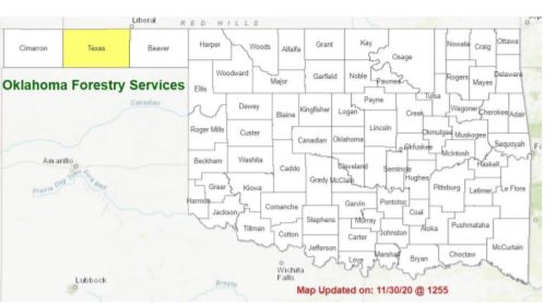
Latest Fire Situation Report Shows No Burn Ban in Texas County
Mon, 07 Dec 2020 13:31:57 CST
 Looking at the Latest Fire Situation Report for December 7th.
PROTECTION AREA STATISTICS November 30 through December 7, 2020 NE Area No New Activity EC Area No New Activity SE Area
5 Fires Burned 81 Acres (Cause: 2-Incendiary, 1- Equipment, 1-Escaped Debris, 1-Escaped Rx Fire) Large /
Significant Fire Activity within the Protection Area: No New Activity Fire Activity with OFS
Response outside of the Protection Area: No New Activity
OFS Prescribed Fire Activity: No New Activity
FIRE DEPARTMENT STATISTICS from www.firereporting.ok.gov recorded on Nov 24-Dec7, 2020 · Light Initial Attack Activity noted in media and informal reporting. Statewide Discussion: Composite fuel moisture improvement and the absence of aligned fire weather elements in the week ahead pose little concern for development of concerning fire danger. Dry conditions are expected through mid-week although decent overnight moisture recoveries and light winds will lead to brief periods of low to moderate fire danger during the afternoon hours conducive to initial attack success.
Above normal temperatures and increased wind speeds Thursday are expected to be offset by increasing moisture limiting afternoon relative humidity values from tapping levels of concern. A late week cold-front ushers in the next opportunity for precipitation as it moves across Oklahoma Thursday into Friday stalling development of fuels drying and fire danger concern. During the course of last week, statewide freezing conditions occurred pushing herbaceous fuels that were hanging on into dormancy and as those fuels become cured, fuels availability will increase.
Today & Tuesday: Snow cover in northwest Oklahoma will continue to diminish with above normal temperatures across the state in the upper 50°'s to mid-60°'s. Afternoon relative humidity values will be in the 25-35% range across much of Oklahoma noting observations in the teens are expected in the western Panhandle.
Light WNW winds around 10 mph with limited gusts will hold rates of fire spread to less than 100 ft./min. unless fuels and wind direction are fully aligned with topographic influence. Wednesday: Warmer temperatures in the mid-50°'s in the Panhandle counties and 62°-71° elsewhere along with southerly winds 10-15 mph and some higher gusts are currently forecasted to be offset with gradually increasing sky cover and increased dew point temperature holding relative humidity values above levels of concern.
Fire behavior should be muted favoring successful initial attack. Near Term Outlook: Precipitation chances return Thursday into Friday. Potential amounts appear to be highest in southeastern Oklahoma; however fire danger is expected to be reduced statewide for a short period. The Oklahoma Wildfire Situation Report will be updated again on Monday, December 14, 2020 unless fire danger or fire occurrence merits otherwise. Burn Bans: Texas County.
WebReadyTM Powered by WireReady® NSI
Top Agricultural News
More Headlines...


