

Agricultural News
Latest Fire Situation Report for February 3, 2021 Shows No Active Burn Bans in the State
Wed, 03 Feb 2021 09:18:44 CST
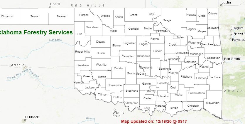 The latest fire situtation report for Feburary 3, 2021 shows no Active Burn Bans Across the State.
PROTECTION AREA STATISTICS February 1, 2020 through February 2, 2021
NE Area 3 Fires Burned 32 Acres (Cause: 1-Escaped Control Burn, 2-Incendiary)
EC Area 1 Fire Burned 3 Acres (Cause: 1-Escaped Debris)
SE Area 2 Fires Burned 14 Acres (Cause: 2-Incendiary)
Large / Significant Fire Activity within the Protection Area: No New Activity
Fire Activity with OFS Response outside of the Protection Area: No New Activity
OFS Prescribed Fire Activity: 1 Rx Treating 80 Acres
FIRE DEPARTMENT STATISTICS from www.firereporting.ok.gov reported February 1-February 2, 2021
· Light Initial Attack Activity Observed
· 2 Fires Burned 68.3 Acres
Statewide Discussion: Dry conditions are in place ahead of an approaching cold front bringing potential for increased initial
attack activity over the two days. This cold front is expected to enter the Panhandle counties early tomorrow morning moving
across the state by early afternoon. While fire environment factors are not fully aligned, the cold front is expected to pass primarily
dry. Another cold front is forecasted to move into Oklahoma Saturday into Sunday ushering in much cooler air. Overall, increased
initial attack activity is expected along with potential for some large fire occurrence where engine and equipment tactics are limited
by topography and/or fuels. Fire danger that develops for a short period this afternoon will quickly wane with sunset.
Today: Respectable overnight moisture recovery and cool temperatures will give way to afternoon high temperatures well above
normal reaching the 70?'s in the Oklahoma Panhandle, far western and southwestern counties and 60?'s elsewhere. Afternoon
relative humidity values are expected to be a little higher than yesterday afternoon with observations below 30% reserved for those
areas tapping 70?. Southerly winds will gradually increase into the afternoon with gusts 20-25 mph. The highest fire danger
indices will be present in the Oklahoma Panhandle and along the western tier of counties.
· Oklahoma Panhandle: Temperatures 71?-77? and afternoon relative humidity values 20-28% under mostly clear skies will
yield very receptive fine fuels at 5%. West to southwest winds will increase through the day 12-18 mph with some gusts
in excess of 20 mph west will support moderate rates of fire spread in typical grass fuels. ROS 105-160 ft./min. with head
fire flame lengths around 10 ft.
· Far Western Oklahoma: Relative humidity values will remain above critical value at 29-36% with temperature 65?-71?.
This will deliver fine-dead fuel moisture values 6-7% are expected noting that some locations may tap 5% briefly is
temperatures exceed forecast. Southerly winds 10-15 mph with some gusts near 20 mph will support moderate rates of
spread during peak burning conditions. ROS in typical grass fuels 97-146 ft./min. with head fire flame lengths 8-11 ft.
should be expected during peak burning conditions.
· Southeastern Oklahoma: Parts of southeastern Oklahoma have received some moisture in recent days although wetting
amounts have not occurred for 25+ days in some locations. As such fuels are receptive and may support active fire
behavior. Temperatures in the low- to mis-60?'s will be in place this afternoon with relative humidity values 33-40% and
fine-dead fuel moisture values 7%. Southeast winds 10-15 mph with some gusts near 20 mph will yield grassland rates
of spread 90-120 ft./min. and flame lengths 5-9 ft. Timber fuels ROS around 20 ft./min. with flame lengths 3-5 ft.
Thursday: The passage of the cold front is expected to be dry holding limited fire danger in place. Again, initial attack activity is
expected to continue with potential for some large fire activity. Fine-dead fuel moisture values are not expected to dip into critical
ranges although continued dry conditions and increasing wind speeds out of the north will support potential for rapid rates of fire
spread in grass dominated fuels on established wildfires.
Near-term: Dry conditions continue on Friday with post-frontal conditions supporting afternoon relative humidity values falling
below 30% across most of the state. Current forecasts hold sustained wind speeds less than 15 mph limiting spread potential
from reaching concerning levels. The next cold front is expected to arrive Saturday and precipitation chances are limited with the
vast majority of the Oklahoma remaining dry ahead of some colder air pushing in. Initial attack activity is expected to gradually
increase into the weekend although potential for large fire occurrence is somewhat limited.
Burn Bans: None
WebReadyTM Powered by WireReady® NSI
Top Agricultural News
More Headlines...

