

Agricultural News
Latest U.S. Drought Monitor Map Shows Some Relief on West Coast With Little Change For Southern High Plains
Thu, 04 Feb 2021 08:51:05 CST
 California's most powerful winter storm of the season brought drought relief in the form of heavy mountain snow this past week.
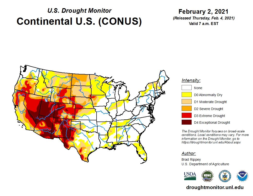
The latest update from the U.S. Drought Monitor shows the storm's impact reached far beyond California bringing drought relief to other areas of the stricken western region.
We still have more than 64 percent of the country experiencing some form of dry or drought condition, which is a 2 percent increase from last week.
Meanwhile, mostly dry weather prevailed in the High Plains.
The region's most significant drought persisted across western Texas where modest increases in coverage of moderate to exceptional drought (D1 to D4) occurred.
According to the USDA, as of late January Texas had more wheat in the poor to very poor condition category (41 percent) than any other state in the region.
To view the U.S. Drought map, click here.
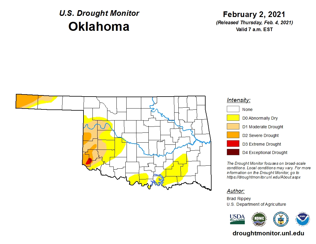
For Oklahoma, the drought map remains virtually unchanged from a week ago with only a small pocket of extreme drought (D3) hanging on in Harmon County in southwest Oklahoma.
Statewide, approximately 75.76 percent of the state is drought free this week.
To view the Oklahoma drought map, click here.
Looking ahead, a series of very cold storm systems could bring additional moisture to Oklahoma and surrounding region, but at this time it appears to be mostly a dry but cold weather pattern.
To view the 6-10-day temperature outlook, click here.
To view the 6-10-day precipitation outlook, click here.
The U.S. Drought Monitor Map is developed through a partnership between the National Drought Mitigation Center at the University of Nebraska-Lincoln, the United States Department of Agriculture, and the National Oceanic and Atmospheric Administration.
WebReadyTM Powered by WireReady® NSI
Top Agricultural News
More Headlines...


