

Agricultural News
U.S. Drought Map Basically Unchanged as Brutal Cold Envelopes Much of The Country
Thu, 11 Feb 2021 10:52:45 CST
 Significant winter precipitation is evident in the latest update from the U.S. Drought Monitor.
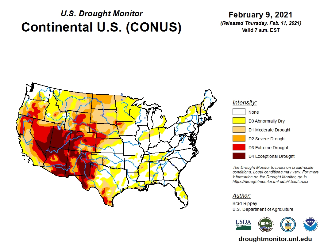
Sub-zero temperatures across much of the mid-section of the country are noted as this is limiting evapotranspiration.
Some short-term dryness is showing up in an area extending from the coastal areas of Texas east and northeast into Mississippi, Louisiana and Tennessee.
A significant area of Extreme Drought (D3) continues to plague eastern Colorado and western Kansas.
Drought deterioration was also noted the High Plains including northern Texas and surrounding areas where topsoil and subsoil moisture percentages are mostly in the short to very short range.
Meanwhile, the northern Plains are covered in snow amounts ranging from a few inches to almost a foot in west central Nebraska.
Forecasts are calling for additional significant snow amounts throughout the High Plains in the coming days.
To view the U.S. Drought map, click here.
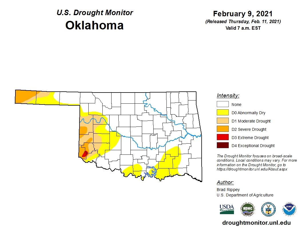
For Oklahoma, the drought map remains virtually unchanged from a week ago with only a small pocket of extreme drought (D3) hanging on in Harmon County in southwest Oklahoma.
Statewide, the total area experiencing no dry or drought conditions has decreased, going from approximately 75.76 percent last week to 72.70 percent this week.
To view the Oklahoma drought map, click here.
Looking ahead, a series of very cold storm systems could bring additional moisture to Oklahoma and surrounding regions.
To view the 6-10-day temperature outlook, click here.
To view the 6-10-day precipitation outlook, click here.
The U.S. Drought Monitor Map is developed through a partnership between the National Drought Mitigation Center at the University of Nebraska-Lincoln, the United States Department of Agriculture, and the National Oceanic and Atmospheric Administration.
WebReadyTM Powered by WireReady® NSI
Top Agricultural News
More Headlines...


