

Agricultural News
Latest U.S. Drought Monitor Map Shows Snow Erased Some Drought Conditions
Thu, 18 Feb 2021 11:17:39 CST
 Persistent brutal cold and snow dominated the latest U.S. Drought Monitor Map and while no one welcomed the frigid temperatures, the snowstorms in the west brought added moisture to the mountain snow packs.
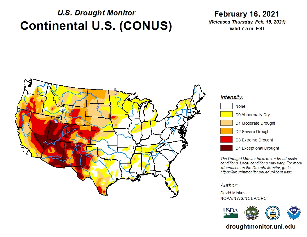
The basin Snow Water Equivalents (SWE) increased throughout the West as many basins were still below normal as of Feb. 16, especially in the southern Rockies.
Light to moderate amounts of mostly frozen precipitation fell throughout Texas, southern Louisiana and Mississippi.
The Gulf Coast area had been experiencing 60-day deficits of three to six inches and this week's precipitation was not great enough to eliminate the drought conditions.
One good thing about the extreme cold, evapotranspiration rates have been low, preventing further moisture loss.
There was some modest improvement in drought conditions in the central and northern High Plains.
Western Kansas and southwest Nebraska remain locked into Extreme Drought (D3), with some smaller areas in northwest Iowa also showing D3.
To view the U.S. Drought map, click here.
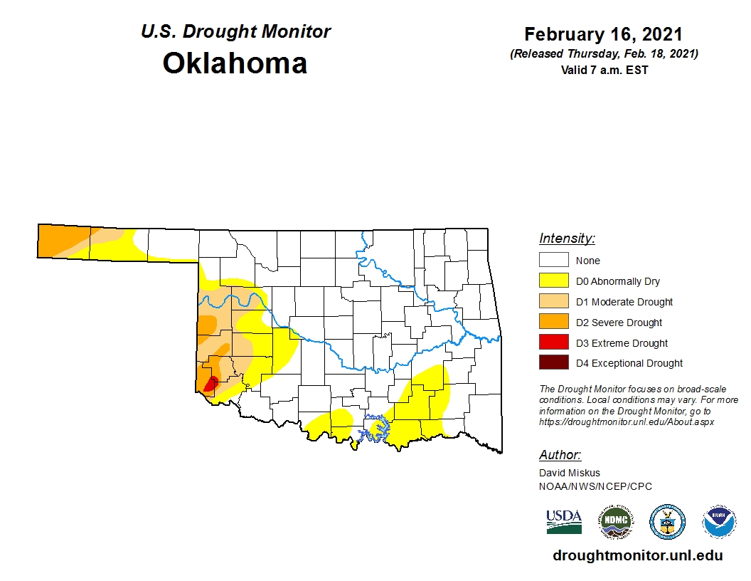
For Oklahoma, the drought map remains unchanged from a week ago with only a small pocket of extreme drought (D3) hanging on in Harmon County in southwest Oklahoma.
Statewide, the total area experiencing no dry or drought conditions remains at 72.70 percent this week.
To view the Oklahoma drought map, click here.
Looking ahead, normal temperatures are expected which would be welcomed following a week of bitter cold.
To view the 6-10-day temperature outlook, click here.
To view the 6-10-day precipitation outlook, click here.
The U.S. Drought Monitor Map is developed through a partnership between the National Drought Mitigation Center at the University of Nebraska-Lincoln, the United States Department of Agriculture, and the National Oceanic and Atmospheric Administration.
WebReadyTM Powered by WireReady® NSI
Top Agricultural News
More Headlines...


