

Agricultural News
Expanding Drought And Wildfire Concerns Show Up on Latest U.S. Drought Monitor Map
Thu, 11 Mar 2021 15:02:55 CST
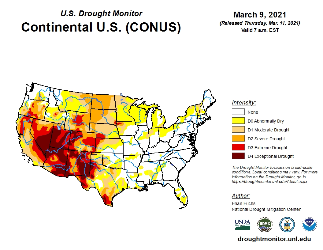
 Precipitation was mostly absent from the continental U.S. during this past week's drought reporting period.
The latest national drought summary indicated there was some precipitation along the Gulf Coast and some storms impacted the Pacific Northwest as well.
Above normal temperatures were recorded across much of the Plains and Midwest, rapidly melting any remaining snow and starting the spring thaw.
Dry conditions dominated the High Plains, especially impacting eastern Colorado and western Kansas.
The Army Corps of Engineers are considering conservation measures on the Missouri River basin if dry conditions continue.
So far this calendar year, basin runoff is estimated at 84 percent of normal.
Drought and wildfire concerns are rapidly growing as livestock producers are already separating out their animals in anticipation of need to sell some off due to drought.
The National Weather Service offices have started making fire weather products more than a month early in response to drought conditions.
So far, 33 fires have burned more than 20,000 acres in North Dakota.
To view the U.S. Drought map, click here.
Click here to view the National Fire Weather Outlook, which is edging ever so close to the Oklahoma Panhandle.
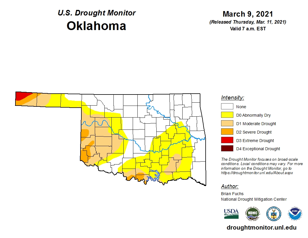
For Oklahoma, warm and windy conditions have dramatically changed the map from a week ago as the total area experiencing drought conditions has increased to 52.23 percent this week. Last week that number was 31 percent.
Most of the increased coverage is in the Abnormally Dry (D0) category, with additional expansion in the Moderate (D1) and Severe (D2) categories.
To view the Oklahoma drought map, click here.
Looking ahead, there is hope that weekend storms could erase much of the drought expansion for Oklahoma and Kansas.
To view the 6-10-day temperature outlook, click here.
To view the 6-10-day precipitation outlook, click here.
The 3-month temperature outlook map for March-April-May, shows above normal temperatures. To view this outlook map, click here.
A dry spring is forecast by NOAA in their 3-month precipitation outlook. To view this outlook, click here.
To view the latest seasonal drought outlook map, click here.
The U.S. Drought Monitor Map is developed through a partnership between the National Drought Mitigation Center at the University of Nebraska-Lincoln, the United States Department of Agriculture, and the National Oceanic and Atmospheric Administration.
WebReadyTM Powered by WireReady® NSI
Top Agricultural News
More Headlines...


