

Agricultural News
Drought Concerns Enhanced For Much of The Country, Including Oklahoma, in Latest NOAA Drought Monitor Update
Thu, 08 Apr 2021 13:59:12 CDT
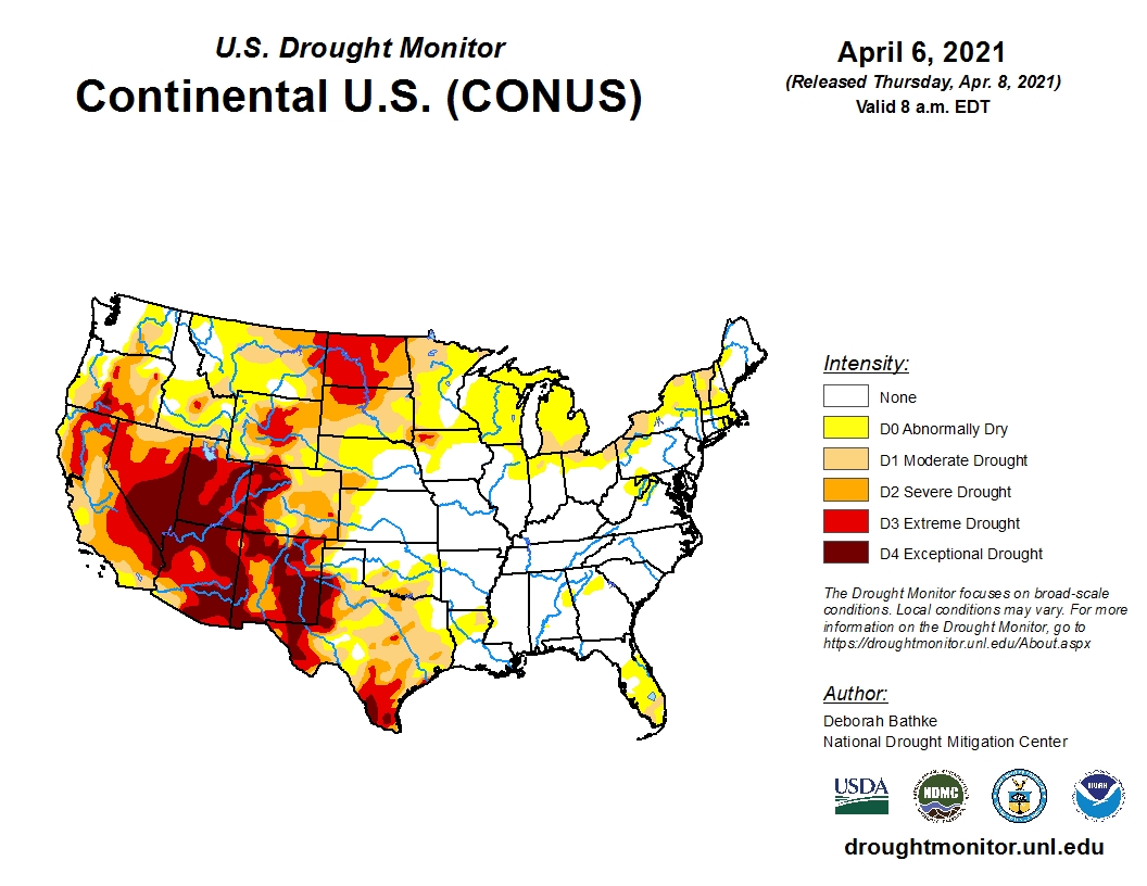
 Temperatures exceeded normal numbers across much of the West and High Plains this past week according to the latest U.S. Drought Monitor update.
High temperatures in Nebraska and the Dakotas reached the upper 70's to mid-80's during the period. The warm temperatures combined with low relative humidity and gusty winds increased wildfire activity and the concerns for expanding drought.
Severe (D2) and extreme (D3) drought expanded in both North and South Dakota.
In North Dakota, we're hearing reports that producers are starting to de-stock livestock herd by culling cows and grain farmers are very concerned about the lack of moisture.
To view the U.S. Drought map, click here.
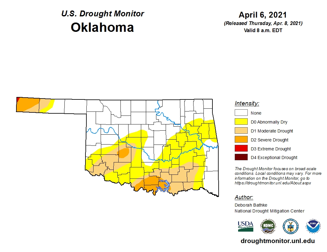
In Oklahoma, the updated drought map shows broad expansions od DO and D1 (moderate drought).
Warm, dry weather combined with high winds increased evaporative demand, drying out soils and vegetation.
The only improvements occurred in the Texas Panhandle and western Oklahoma.
Currently almost 50 percent of the state is experiencing some form of drought condition.
There is still that lingering sliver of D3 in northwest Cimarron County in the Oklahoma Panhandle that has persisted for months.
To view the Oklahoma drought map, click here.
Looking ahead, well below normal temperatures are expected with above normal precipitation, especially in far western Oklahoma.
To view the 6-10-day temperature outlook, click here.
To view the 6-10-day precipitation outlook, click here.
The 3-month temperature outlook map for April-June, shows above normal temperatures. To view this outlook map, click here.
A dry spring is forecast by NOAA in their 3-month (April-June) precipitation outlook. To view this outlook, click here.
There is some good news in the latest seasonal drought outlook for Oklahoma.
Unfortunately, drought conditions will persist into summer for much of the western and southwestern U.S.
To view the latest seasonal drought outlook map, click here.
The U.S. Drought Monitor Map is developed through a partnership between the National Drought Mitigation Center at the University of Nebraska-Lincoln, the United States Department of Agriculture, and the National Oceanic and Atmospheric Administration.
WebReadyTM Powered by WireReady® NSI
Top Agricultural News
More Headlines...


