

Agricultural News
Drought Concerns For The Western Half of U.S. Expand According to The Latest Drought Monitor Map
Thu, 29 Apr 2021 08:57:44 CDT
 Multiple weather systems moved across the U.S. this past week bringing drought relief to some areas of the Plains but leaving many without substantial moisture.
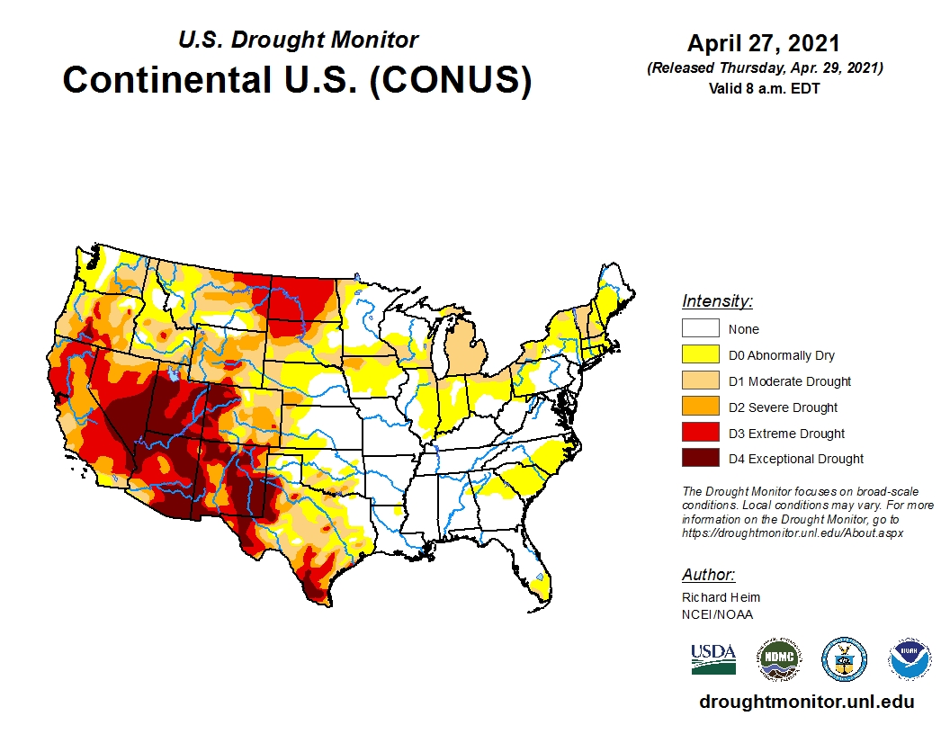
The latest update from the U.S. Drought Monitor shows above normal precipitation fell across parts of the West, much of the Gulf Coast from eastern Texas and Oklahoma to Georgia and parts of the northern Great Lakes.
In the southern Plains, the western half of Texas and Oklahoma were dry with little to no rain falling.
Dry or very dry soils grew in area to 67 percent of Texas and 29 percent of Oklahoma.
In the Midland-Odessa, Texas area, 2020-2021 had the driest 13-month April-April period on record.
Falling levels of the Edwards Aquifer triggered water restrictions in several Texas communities, including San Antonio, New Braunfels and San Marcos.
There were patches of 0.5-1.0 inch of precipitation in southeast Kansas, the Dakotas, Wyoming, Colorado and the western half of Montana this week.
Exceptional Drought (D4) in northwest Colorado and abnormally dry (D0) expanded in southwest Kansas.
To view the U.S. Drought map, click here.
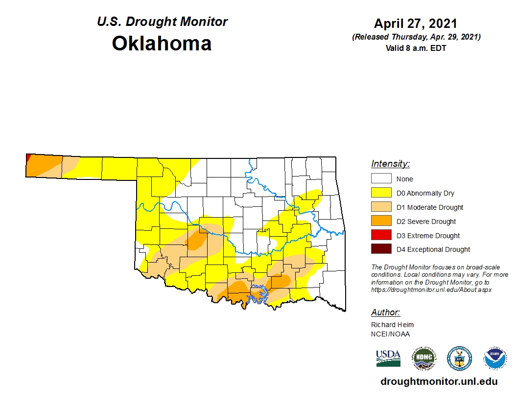
In Oklahoma, the updated drought map shows 56.40 percent of the state is experiencing some type of dryness.
Just a short three months ago, barely one-fourth of Oklahoma was experiencing dry conditons.
Interestingly, one year ago, only 14.04 percent of the state was in drought.
To view the Oklahoma drought map, click here.
Looking ahead, the month of May is going to start with below normal temperatures and below normal precipitation.
A big concern is the forecast dryness for the Oklahoma Panhandle and most of Kansas.
To view the 6-10-day temperature outlook, click here.
To view the 6-10-day precipitation outlook, click here.
A dry spring is forecast by NOAA in their 3-month (April-June) precipitation outlook. To view this outlook, click here.
Unfortunately, drought conditions will persist into summer for much of the western and southwestern U.S. and is expected to expand. The updated seasonal drought outlook map shows almost half the country will be in drought conditions during the next three months.
To view the latest seasonal drought outlook map, click here.
The U.S. Drought Monitor Map is developed through a partnership between the National Drought Mitigation Center at the University of Nebraska-Lincoln, the United States Department of Agriculture, and the National Oceanic and Atmospheric Administration.
WebReadyTM Powered by WireReady® NSI
Top Agricultural News
More Headlines...


