

Agricultural News
Latest U.S. Drought Monitor Map Shows Oklahoma Mostly Void of Drought Conditions
Thu, 03 Jun 2021 09:05:11 CDT
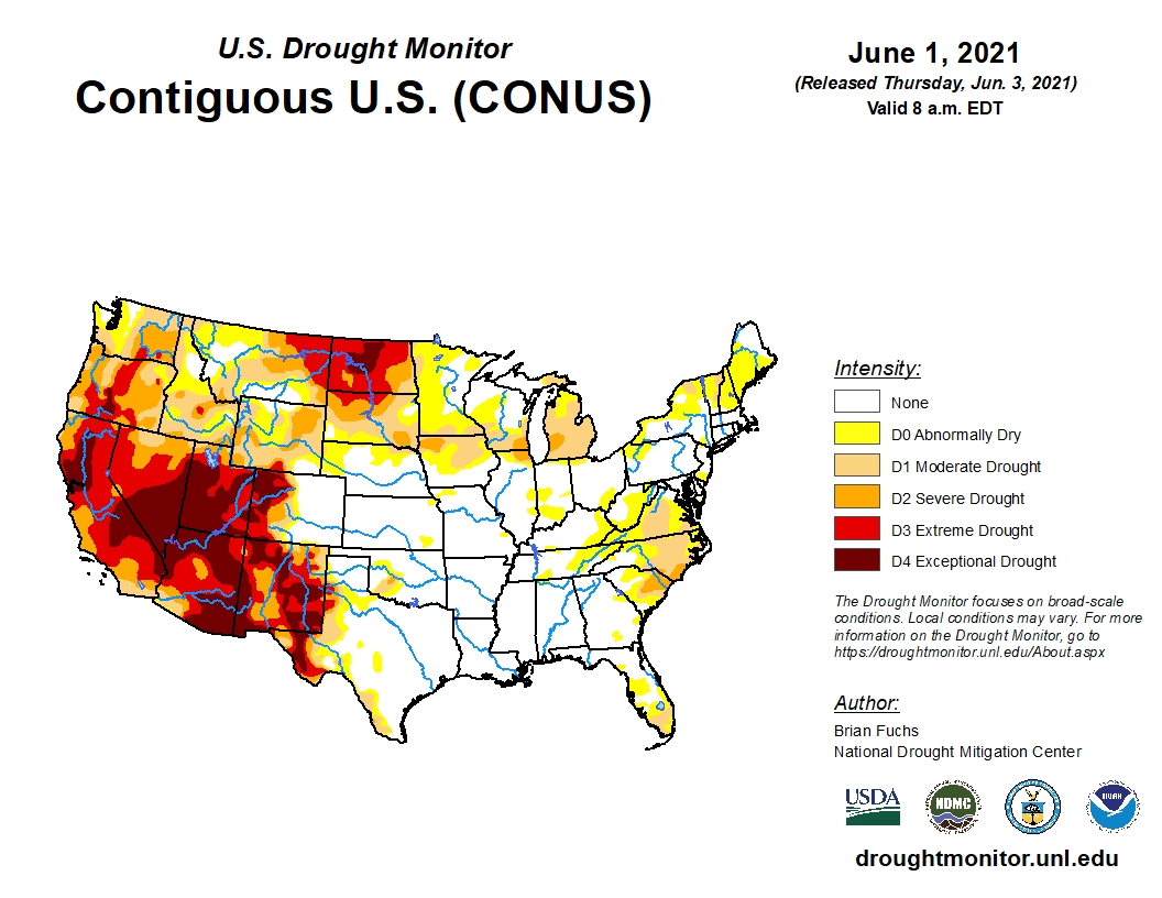
 Precipitation this past week was most active in the southern Plains and the Mid-Atlantic into the Northeast, helping ease and improve drought in those regions, according to the latest U.S. Drought Monitor.
Temperatures were well below normal over most of the country with departures of 9-12 degrees below normal in the Dakotas. Even greater differences of 15-20 degrees below normal were noted for parts of the central and southern Plains.
Much of eastern Colorado, southern Nebraska, Kansas and northwest South Dakota received well over 150 percent of normal precipitation during the period.
To view the U.S. Drought map, click here.
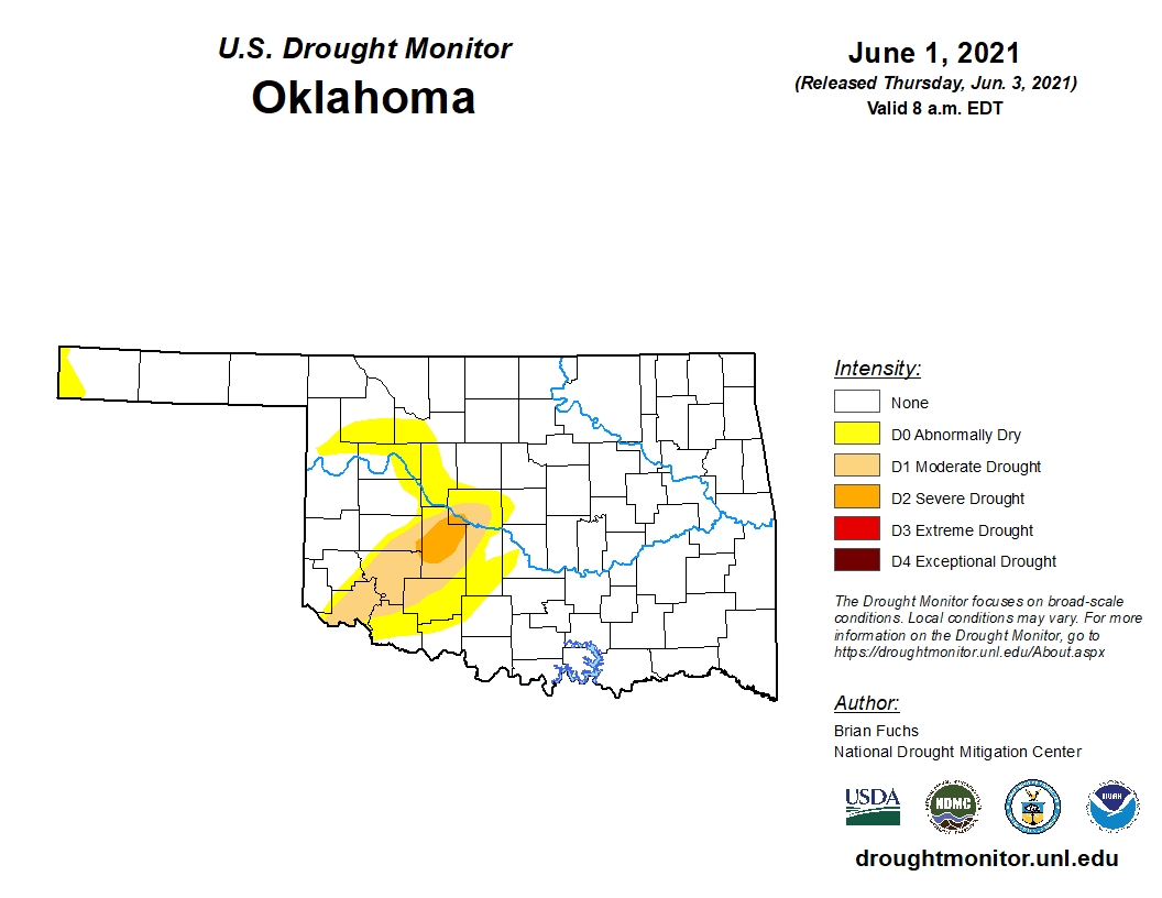
In Oklahoma, it has been more than a year since we have seen a map this void of drought shades.
Following a very wet week, 84.37 percent of the state is free of any drought designation. Last week that number was 64.15 and one year ago it was 70.07.
To view the Oklahoma drought map, click here.
Looking ahead to next week, a mix of below and above normal temperatures and precipitation is expected for Oklahoma.
To view the 6-10-day temperature outlook, click here.
To view the 6-10-day precipitation outlook, click here.
A normal summer, precipitation-wise, is now forecast by NOAA for much of the Oklahoma. To view this outlook, click here.
There is good news in the latest seasonal drought outlook as NOAA expects drought removal likely in southwest and southern Oklahoma.
Unfortunately, the drought will persist and intensify for much of the western, northern and southwestern U.S.
To view the new seasonal drought outlook map, click here.
The U.S. Drought Monitor Map is developed through a partnership between the National Drought Mitigation Center at the University of Nebraska-Lincoln, the United States Department of Agriculture, and the National Oceanic and Atmospheric Administration.
WebReadyTM Powered by WireReady® NSI
Top Agricultural News
More Headlines...


