

Agricultural News
Drought Monitor Shows Scorching Conditions in Western U.S.
Thu, 08 Jul 2021 09:37:02 CDT
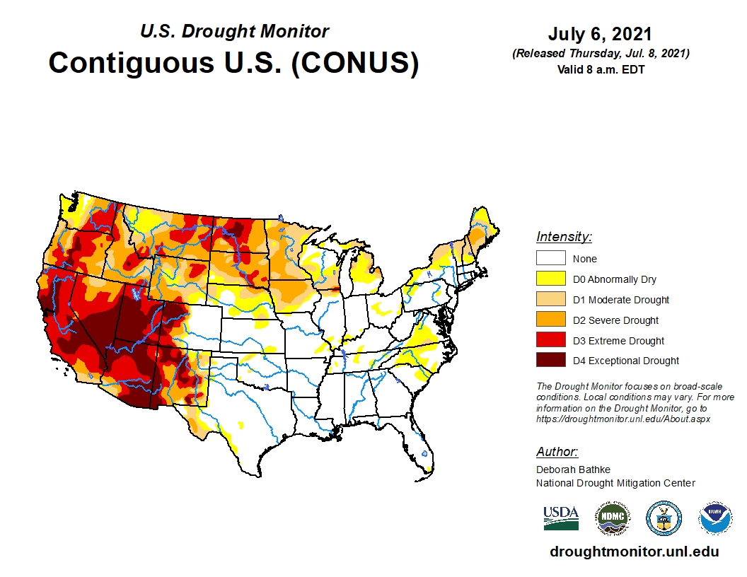
 Another week of hot, dry weather in the Pacific Northwest, Northern Rockies, Northern Plains, and Upper Midwest led to the expansion of drought conditions. Meanwhile, monsoon thunderstorms brought wet weather to eastern New Mexico and West Texas resulted in large one-category improvements according to the latest U.S. Drought Monitor update.
Substantial rain fell across much of the South again this week, leading to large areas of one-category improvements to remaining drought areas in Texas and Oklahoma, where rainfall deficits, soil moisture, and streamflow improved. A two-category improvement was made in far West Texas near El Paso, where more rainfall has been recorded in the last nine days than in the prior 15 months.
Also receiving beneficial rainfall is the Southeast and Midwest regions. Wet weather continued this week over much of the lower Midwest, leaving that part of the region drought-free with pockets of abnormal dryness (D0).
Across the northern tier, drought expanded in Minnesota and Iowa as high temperatures of 6 to 9 degrees above normal, combined with little or below normal rainfall, dried out soils and stressed vegetation. Rainfall deficits of 4 to 10 inches are present over the last 90 days.
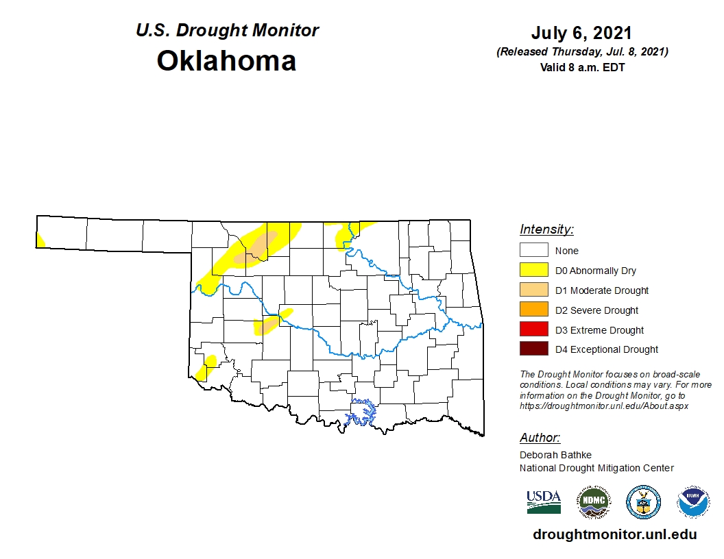
In Oklahoma, D0 to D1 (Abnormally Dry to Moderate Drought) conditions can be seen in the northwestern part of the state, along with small spots across the western half.
Moving into next week, the Climate Prediction Center six-to-10 day outlook (valid July 13-17) favors above normal temperatures across much of Alaska, the West, northern Plains and Northeast. Below normal temperatures are most likely across the Southern Plains.
To view the U.S. Drought map, click here.
In Oklahoma, strides forward are being taken as 93.13 percent of the state is drought free. This compares to 50.20 percent three months ago and 33.10 percent one year ago.
There are no shades of bright orange (D2 severe drought) and very little light orange (D1 moderate drought) on the Oklahoma map this week.
To view the Oklahoma drought map, click here.
Looking ahead to next week, temperatures will remain below normal for the southern half of the state and normal for the northern and western parts of the state.
Precipitation will remain normal for the majority of the state, with the slight possibility of below normal amounts in the Oklahoma Panhandle.
To view the 6-10-day temperature outlook, click here.
To view the 6-10-day precipitation outlook, click here.
A normal to above average summer, precipitation-wise, is now forecast by NOAA for much of the Oklahoma. To view this outlook, click here.
There is more good news in the latest seasonal drought outlook as NOAA expects drought removal likely for the majority of Oklahoma and the South.
Unfortunately, the drought will persist and intensify for much of the western, northern and southwestern U.S.
To view the new seasonal drought outlook map, click here.
The U.S. Drought Monitor Map is developed through a partnership between the National Drought Mitigation Center at the University of Nebraska-Lincoln, the United States Department of Agriculture, and the National Oceanic and Atmospheric Administration.
WebReadyTM Powered by WireReady® NSI
Top Agricultural News
More Headlines...


