

Agricultural News
Weather Extremes Experienced Across the U.S. While Western Drought Progresses
Thu, 15 Jul 2021 11:48:15 CDT
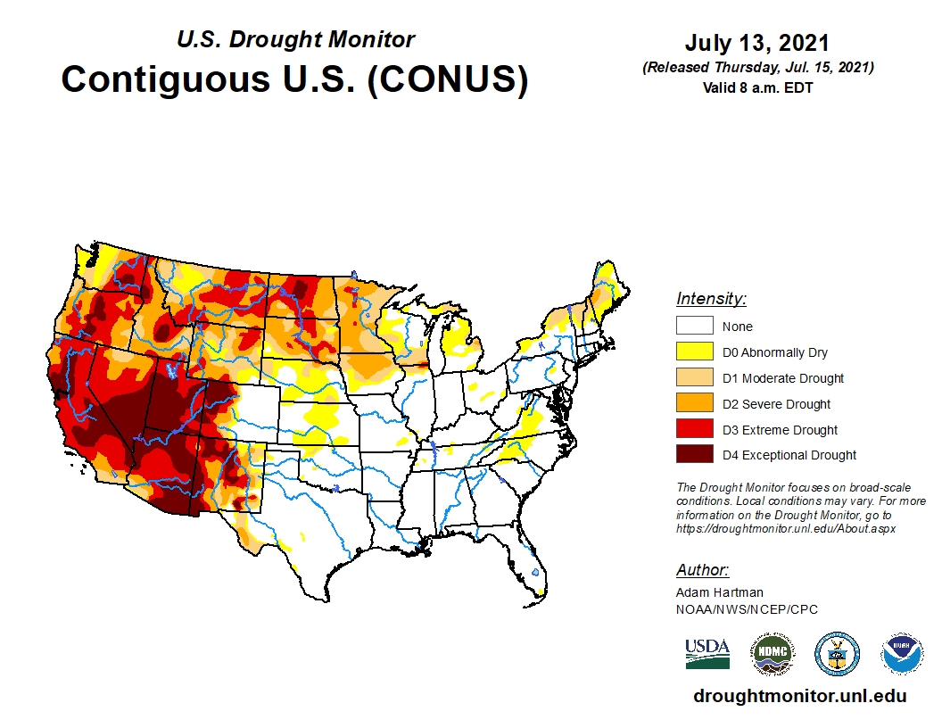 Extremes were experiences across the U.S. this week, with expansion of drought in the West, a robust Southwest Monsoon in the Southwest, a tropical storm making landfall in the Southeast, and extreme flooding in southeastern Texas.
In the West, mid-level ridging has resulted in much above-normal temperatures for the western third of the CONUS, exacerbating drought conditions in the Pacific Northwest, northern Great Basin, Northern Rockies, and along the Front Range.
Above-normal temperatures also pushed into the northern High Plains, warranting further deterioration of drought conditions in locations where rainfall remained below-average for the week.
The central and eastern Corn Belt was a battle ground of sorts, with some locations seeing improvement with this week's heavy rainfall, while other locations missed out, warranting some degradation due to antecedent dryness.
A localized area of low pressure brought severe flooding to much of southeastern Texas, with many locations in and around the Houston metro area receiving 10 to 15 inches of rainfall. Some of the precipitation associated with this system made it farther westward, resulting in 1-category improvements (D0 and D1) along the Rio Grande.
Moving into next week, the Climate Prediction Center six-to-10 day outlook (valid July 20-24) favors above normal temperatures across much of the West and northern Plains. Below normal temperatures are most likely across the Southern Plains, East and Northeast.
To view the U.S. Drought map, click here.
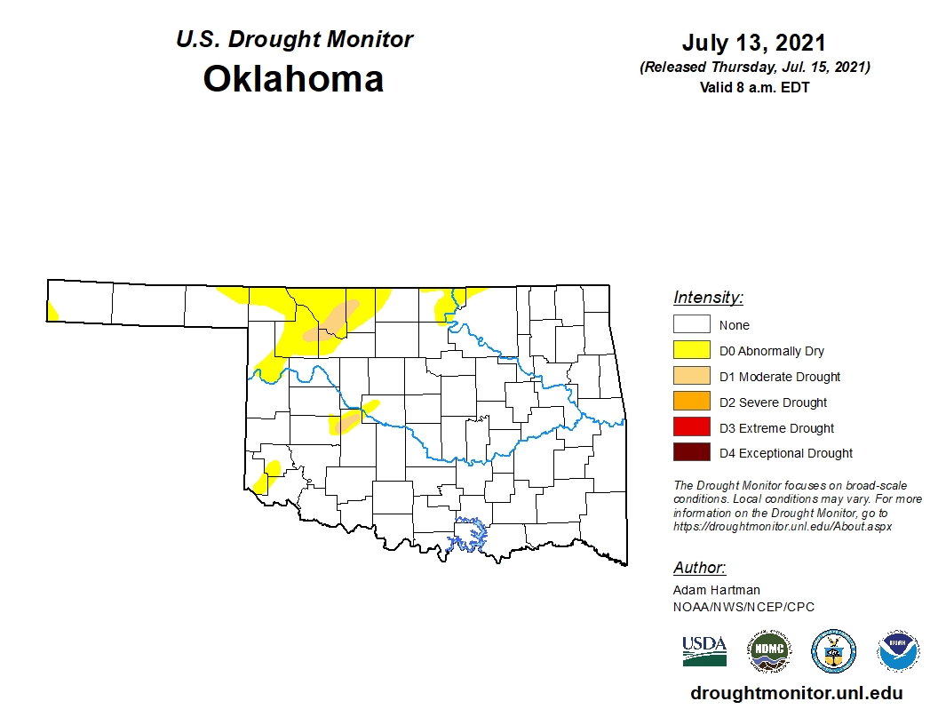
In Oklahoma, optimism is high as 90.53 percent of the state remains drought free. This compares to 47.00 percent three months ago and 39.08 percent one year ago.
There are no shades of bright orange (D2 severe drought) and very little light orange (D1 moderate drought) on the Oklahoma map this week. A small sector of the northwestern part of the state is experiencing abnormally dry conditions (D0).
To view the Oklahoma drought map, click here.
Looking ahead to next week, temperatures are predicted to remain below normal for the entire state and surrounding areas.
Precipitation is expected to remain normal for the southern half of the state, with normal to below normal levels in the northern half and the Oklahoma Panhandle region.
To view the 6-10-day temperature outlook, click here.
To view the 6-10-day precipitation outlook, click here.
A normal to slightly below average summer, precipitation-wise, is now forecast by NOAA for much of the Oklahoma. To view this three-month outlook, click here.
There is more good news in the latest seasonal drought outlook as NOAA expects little-to-no drought for the majority of Oklahoma and the South.
Unfortunately, the drought will persist and intensify for much of the western, northern and southwestern U.S.
To view the new seasonal drought outlook map, click here.
The U.S. Drought Monitor Map is developed through a partnership between the National Drought Mitigation Center at the University of Nebraska-Lincoln, the United States Department of Agriculture, and the National Oceanic and Atmospheric Administration.
WebReadyTM Powered by WireReady® NSI
Top Agricultural News
More Headlines...


