

Agricultural News
Friday, January 7, 2022, Fire Situation Report: 18 Acres Burned
Fri, 07 Jan 2022 12:33:44 CST
 According to Wednesday's Fire Situation Report from the Oklahoma Forestry Services, two small fires burn nearly 18 acres.
Statewide Discussion: A frigid start to the day will give way to gradually warming temperatures as winds switch back to the south. Dry conditions will be present across the state today encouraging receptive fuels this afternoon. With wind speeds less than critical, fire activity today should provide ample opportunity for successful initial attack. A surge of gulf moisture on Saturday will prompt some rain chances southeast holding fire danger concerns to far western and northwestern Oklahoma confined to a brief period in the afternoon. A cold front Saturday night will bring seasonal conditions with moderate fire danger indices again focused in the west. No significant fire activity anticipated.
Today: No critical fire weather is expected. The highest fire danger indices will develop this afternoon in the western and Panhandle counties where fuels are driest. As temperatures warm in the west to 38?-50? (upper 50?'s in the western Panhandle), afternoon relative humidity values will settle briefly at 23-35% holding fine-dead fuel moisture above critical values. Southerly winds will increase to 15-20 mph in the area along with higher gusts although rates of fire spread will support successful initial attack efforts. Rangeland fuels rates of spread will generally be under 150 ft/min. Central and eastern Oklahoma regions will lower fire danger indices and reduced fire spread potential.
Friday: Saturday will bring above normal temperatures again although a surge of gulf moisture, ample sky cover and rain chances southeast will moderate fire danger over much of the state. Fire danger concern will again be focused in the far western and Panhandle counties for a few hours in the afternoon preceding sunset. In this area, temperatures will warm into the 60?'s with some 70? observations southwest along with afternoon relative humidity values 22-35%. Winds will shift from the south to northerly 10-18 mph with some higher gusts. Rates of spread in rangeland fuels will max out around 140 ft/min again offering good opportunity for successful initial attack.
Near Term: A cold front moving across Oklahoma Saturday night will result in more seasonable temperatures on Sunday and improved dew point temperature will hold afternoon relative humidity values above critical value. No significant fire occurrence anticipated. Peering into next week, no critical fire weather is expected noting that dryness persists in the west. There is opportunity for meager amount of precipitation in western Oklahoma in the 7-day outlook, but little hope for meaningful amounts.
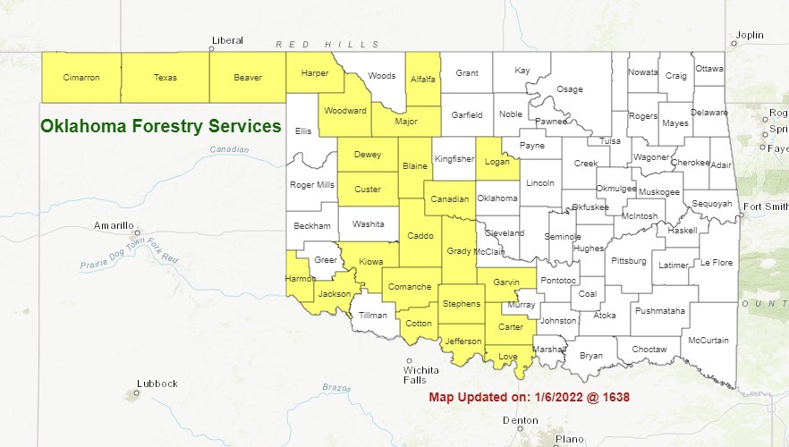
See the burn ban map above for the latest counties under burn bans.
WebReadyTM Powered by WireReady® NSI
Top Agricultural News
More Headlines...


