

Agricultural News
Some Rainfall Across the State Helps with Fire Danger, but Concerns with Severe Weather Elevate
Mon, 02 May 2022 09:37:12 CDT
 Statewide Discussion: A Red Flag Warning is in effect from 1:00 PM through 8:00 PM today for Harmon County. The dryline will attempt to push into western Oklahoma today stalling in far western Oklahoma with warm, dry and breezy conditions west of the boundary. Elevated fire weather will develop across this area although may locations received rain last night mitigating the large/significant fire concern in large part. Severe weather potential ramps up late this afternoon and evening for central and eastern Oklahoma. Fire danger moderates through much of the week and rainfall received will be important as fire weather returns this weekend to western Oklahoma.
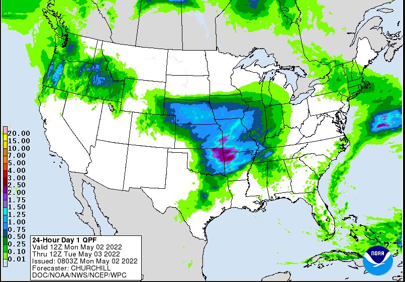
Today: Rainfall yesterday evening and overnight will mitigate some of the concern across western Oklahoma today to some extent noting that southwest Oklahoma received only scant amounts. Rainfall in the last twenty-four hours combined with a few heavier bands of rain last week has promoted some transition to live-fuel moisture improvement serving as a heat sink on the fire ground limiting fire behavior potential. The dryline will push just past the 100th Meridian today and fire danger emphasis will be in far southwestern Oklahoma where warm, dry and windy conditions will occur over fuels and separation from wetting rains spans 12-41 days. Significant fire potential is very limited with an expectation that fires should be contained during initial attack. Large fore potential favors far southwestern Oklahoma id a fire occurs in adverse fuels.
• Warned Area Harmon County: Temperature will warm to 94° with 10% relative humidity values behind the dryline driving fine-dead fuel moisture values to 3% with some localized areas of 2%. Southwest winds sustained 19-26 mph with some gusts approaching 35 mph will support potential for rapid rates of fire spread in grass-dominated fuels. Rangeland fuels will support rates of spread 160-210 ft/min and flame lengths 12-14 ft on fully established fires. Winds will shoft to westerly this evening and northwest overnight as a cold front enters the area.
• Western Oklahoma: Skies will clear as the dryline pushes east into the western tier of counties and Oklahoma Panhandle. Rainfall amounts overnight were variable ranging from a few one-hundredths to around1.5" in southern Ellis County. West of the dryline, temperature will warm into the 75° (western Panhandle) to the low 90°'s with relative humidity values 12-24%. Winds will become southwest to west sustained 22-30 mph with some gusts late in the burning period topping 40 mph as the front approaches. Where fires do become established, rates of spread in grass-dominated fuels will be observed around 150-190 ft/min. Initial attack may prove challenging, but is expected to be successful. Near-Term: Storm chances increase this afternoon and evening into the overnight hours with severe potential across central and eastern regions of the state.
Rain, and storm chances, enter the mix again on Wednesday with some promise of broader wetting rain potential including western Oklahoma. Those observed rain amounts will be important for gauging fire potential this weekend as warm, dry and windy conditions return.
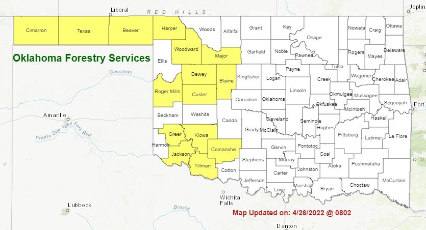
Burn Bans: Refer to: https://ag.ok.gov/divisions/forestry-services/ for the most current burn ban information and links to specific burn ban proclamations.
WebReadyTM Powered by WireReady® NSI
Top Agricultural News
More Headlines...


