


Agricultural News
Exceptional Drought Returns to Small Part of Western Oklahoma- The Latest Pictures
Thu, 26 Jul 2012 10:13:30 CDT
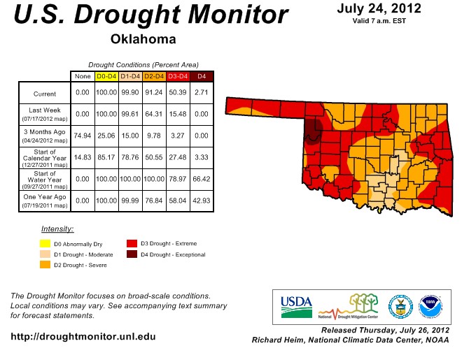 Driven by intense heat, wind and one of the driest May-July periods on record, the flash drought and its impacts continued to accelerate in Oklahoma. The U.S. Drought Monitor map released this morning now portrays 91% of the state in at least severe drought (D2-D4), the most since Nov. 8, 2011. Exceptional (D4) drought also makes an unwelcome return to Oklahoma in Ellis and Roger Mills counties, its most significant presence since early March 2012 when drought was seemingly on the way towards extinction. A scant three months ago, only 15% of the state was even considered in any type of drought, at least according to the Drought Monitor. The latest Drought Monitor map for Oklahoma is at the top of the page.
More than 50% of the state is now portrayed in extreme-exceptional drought, the most since Nov. 15, 2011. At this time last year, more than 50% of the state was covered in exceptional drought, with 70% in the extreme-exceptional categories.
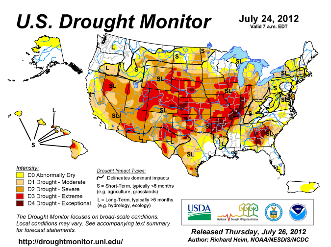
The severity of the drought on a national scale also increased accordingly. More than 38% of the country is now considered to be in severe-exceptional drought, the most since the Drought Monitor effort began in 2000 (last week's extent and also the Sept. 10, 2002, amounts rank #2 and #3). The latest National Drought Monitor map is below.
Just below the US Drought Monitor map are two pictures from Greer County Conservation District and a third from the Central NorthCanadian River Conservation District. The first picture from Greer County is some dryland cotton damaged by the drought, the second picture is the dried up river bed of the Salt Fork of the Red River and the third picture down from Canadian County is a rapidly drying up pond.
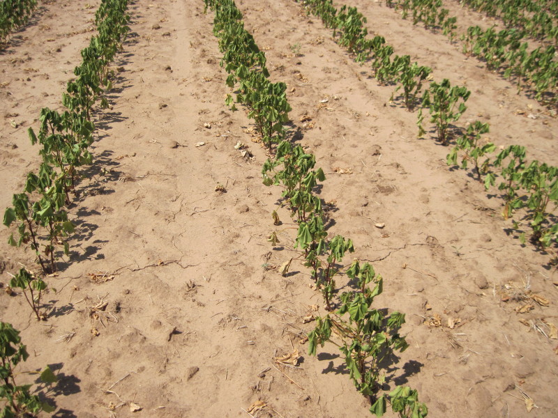
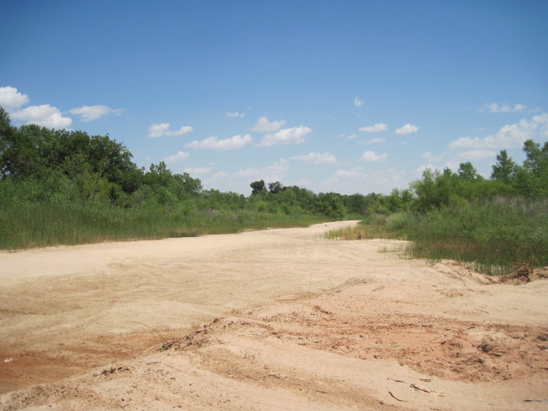
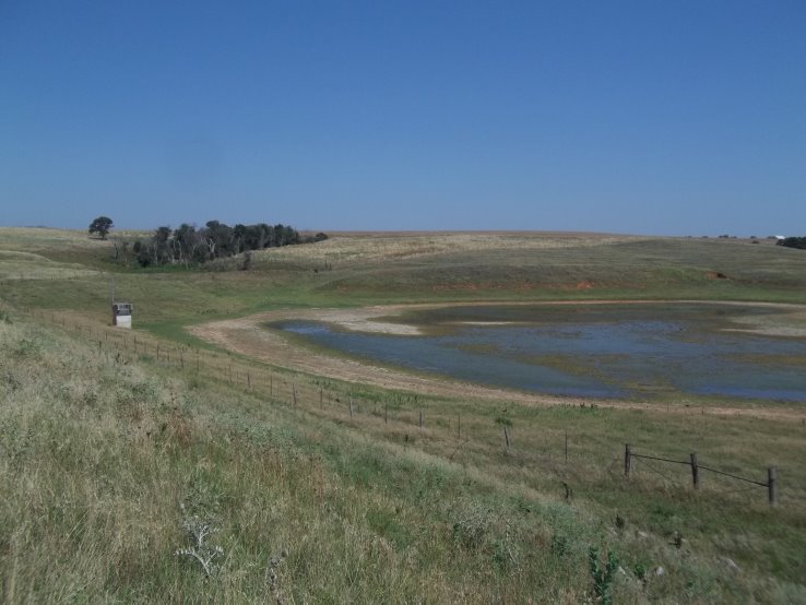
Oklahoma Drought Monitor map is at the top of the page, followed by the US Drought Monitor graphic, dryland cotton in Greer County, the dry riverbed of the Salt Fork of the Red River and a pond with very low water levels in Central Oklahoma.
WebReadyTM Powered by WireReady® NSI
Top Agricultural News
More Headlines...


