


Agricultural News
Issac to Bring Rain Into Eastern Oklahoma- The Latest Maps on Issac and the Drought Monitor
Thu, 30 Aug 2012 08:18:54 CDT
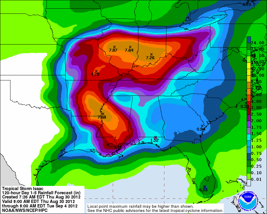 Tropical Depression Issac may include portions of Eastern Oklahoma in the rainfall that is headed inland from the Gulf, based on the latest projections from the National Weather Service- heaviest amounts of rainfall have already fallen along the coast- but amounts in excess of seven inches are likely in southeastern Arkansas and then further north into Illinois and Indiana before this stystem finally disappears.
For Oklahoma, the rainfall amounts as shown in the graphic above are more modest, but a lot of eastern Oklahoma might see an inch of rainfall from this tropical event.
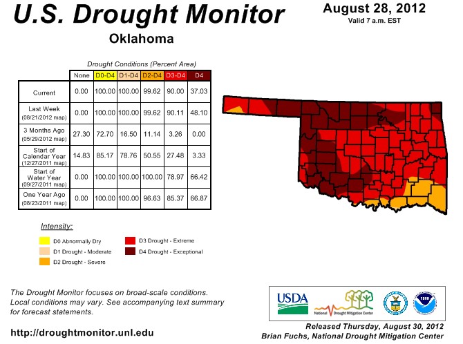
Meanwhile, the latest Drought Monitor has been released- and while the entire state remains under at least the minimal level of drought- moderate drought, the amount of "exceptional" drought has declined in the latest week from 48% down to 37%- mostly in the western half of the state- the part of the state that will be ignored by Issac.
The cumulative effect of the last two weekend's rainfall events was enough to draw some of the state out of exceptional drought. Unfortunately, those that missed out on those two rainfall events were drawn into the U.S. Drought Monitor's worst drought category. Parts of northeastern and central Oklahoma improved from exceptional drought to extreme drought, including the state's two most populous cities in Oklahoma City and Tulsa.
The latest Drought Monitor map is below.
WebReadyTM Powered by WireReady® NSI
Top Agricultural News
More Headlines...


