


Agricultural News
Impressive Rainfall Totals- Here's the Latest Mesonet Graphic
Fri, 22 Feb 2013 06:23:08 CST
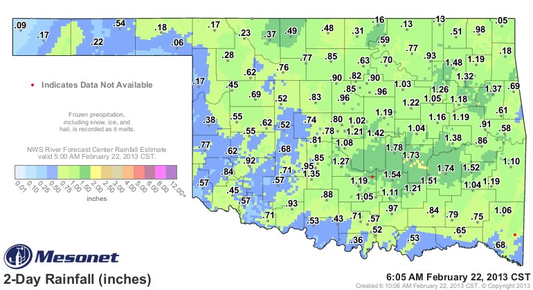 Rainfall totals across southern Oklahoma continued to build during the day yesterday- and with this latest system now out of the state- here is the Mesonet map that shows liquid preciptiation over the last 48 hours. (as of 6 AM Friday, February 22, 2013)
One station that is not reporting on this grahic that is above is the Byars station just north and east of Pauls Valley- the last actual number we saw from them was over two inches of rainfall- but in this map update- they are shown to be offline.
Over two dozen Mesonet locations have recorded over an inch of liquid rainfall- and many other locations- especially north of I-40 could push over that mark as snow melts today and into the weekend.
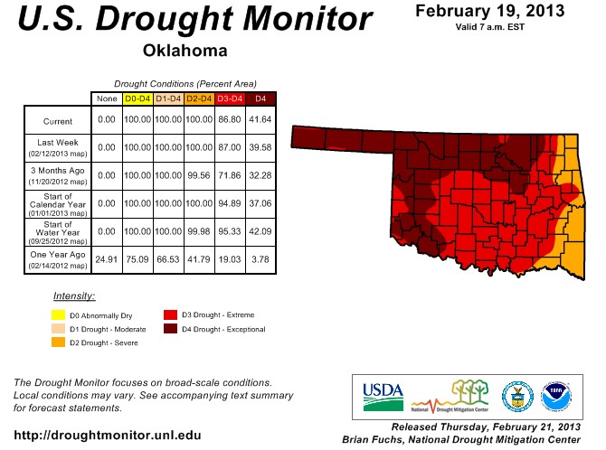
This widespread rainfall could help put a small dent into the Drought Monitor map when it is revised next week- below is the latest map that was released on Thursday morning- that continues to show vast areas of the state in extreme to exceptional drought.
WebReadyTM Powered by WireReady® NSI
Top Agricultural News
More Headlines...


