


Agricultural News
Weather Maps to Check- Drought Monitor, Precipitation Chances and Severe Weather Outlook
Fri, 17 May 2013 05:51:29 CDT
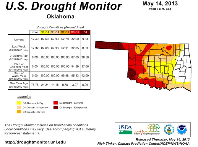 Drought conditions in Oklahoma were little changed this past week, with exceptional drought continuing in a little less than ten percent of the state- four counties are impacted in far southwestern Oklahoma including Jackson, Harmon, Greer and Kiowa Counties. The latest Drought Monitor map is above.
In the Panhandle- we find the rest of the exceptional drought in the state- with all of Cimarron and Texas counties in the D4 reading, while about half of Beaver county is in that same level of dryness.
A little over 17% of the state is out of drought or abnormally dry conditions- pretty much all in east central Oklahoma- and when you add in abnormally dry readings but no longer in drought- you come up to about one third of the state in these categories.
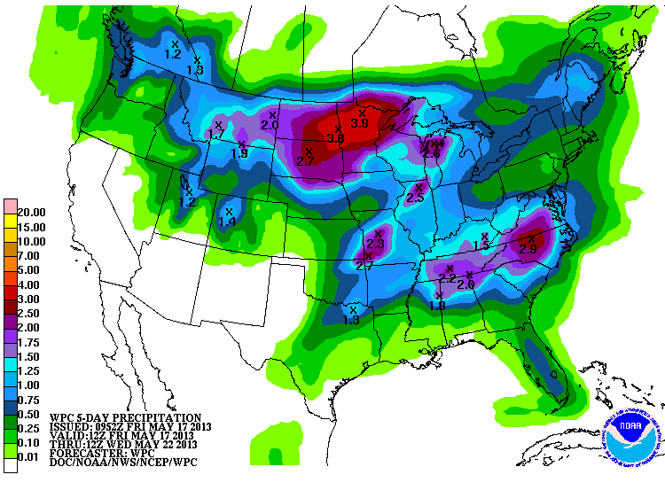
The next map below is of the five day precipitation forecast- and we have chances of measurable rain in the central and eastern counties of the state- the driest areas see little chance of rainfall from this next storm system.
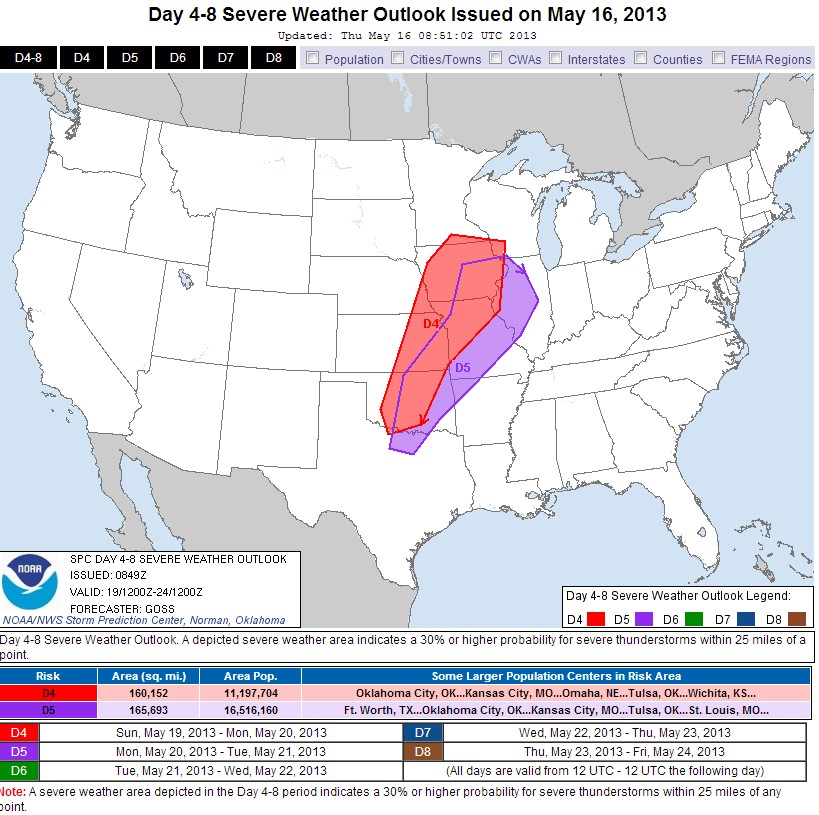
The bottom graphic shows the chances of storms slicing and dicing Oklahoma and points north and east- chances are in the mix for both Sunday and Monday evenings.
According to Alan Crone with the News on 6, "We've made it to the weekend but a major storm system will be approaching the southern and central plains providing a chance for severe weather across a large portion of the plains states, including part of Oklahoma. All modes of severe weather will be possible including large hail, damaging winds, and possibly tornadoes. The main window for severe weather for our immediate area will begin Sunday and may not end until early Tuesday morning. This does not mean storms will be likely during this entire time period, but the chance for thunderstorm development will be increasing during these periods.
"A major upper level trough will move slowly eastward to near the four corners area by late this weekend. Strong winds aloft will overspread the state by Sunday into Monday. A surface dry line will be positioned across western OK Friday through the weekend. A dry line separates warm and moist air from dry and hot air. Locations east of the dry line today and tomorrow will have a chance of isolated storm development, but most if not all of the storms will reside well west of our areas."
WebReadyTM Powered by WireReady® NSI
Top Agricultural News
More Headlines...


