


Agricultural News
Heat Dome Builds Over Oklahoma; Temperatures Soar Near Triple Digits
Mon, 26 Aug 2013 21:21:36 CDT
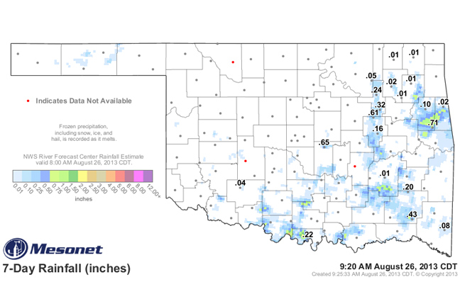
Hot, dry weather has settled in over Oklahoma and Associate State Climatologist Gary McManus says the current seven- day rainfall map pictured above is the worst he's seen in quite a while. (You can listen to Gary's take on the current weather situation by clicking on the LISTEN BAR at the bottom of this story.)
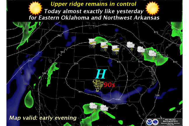
He says the next seven days don't seem that much better due to a heat dome being parked right over the region.
High temperatures are flirting with triple digits in southwest Oklahoma and the upper nineties are will be commonplace over the rest of the state.
The graphic at the bottom of this page shows exactly what's going on as that upper ridge of high pressure sits and spins over the south-central U.S.
The National Weather Service in Norman shows that other than a slight chance for showers in the far southwest tomorrow, it will be more of the same for the next week. Temperatures are not out of control, but they're still a bit above normal (and a LOT above where they were earlier in the month).
In the meantime, the soils are starting to dry back out a bit, McManus said, so it's important to get more rain in the next month in time for planting season. Still plenty of time before that, and Mother Nature has been coming through most of the time.
Even with this dry spell, August is still about 0.7" above normal for the month thus far with a statewide average of 3.03". Now unfortunately, the southern parts of the state are still below normal, so the statewide average cannot explain everything.
WebReadyTM Powered by WireReady® NSI
Top Agricultural News
More Headlines...


