


Agricultural News
Now You Can Call It Cleon- Winter Weather Arriving- The Latest Maps
Thu, 05 Dec 2013 06:00:56 CST
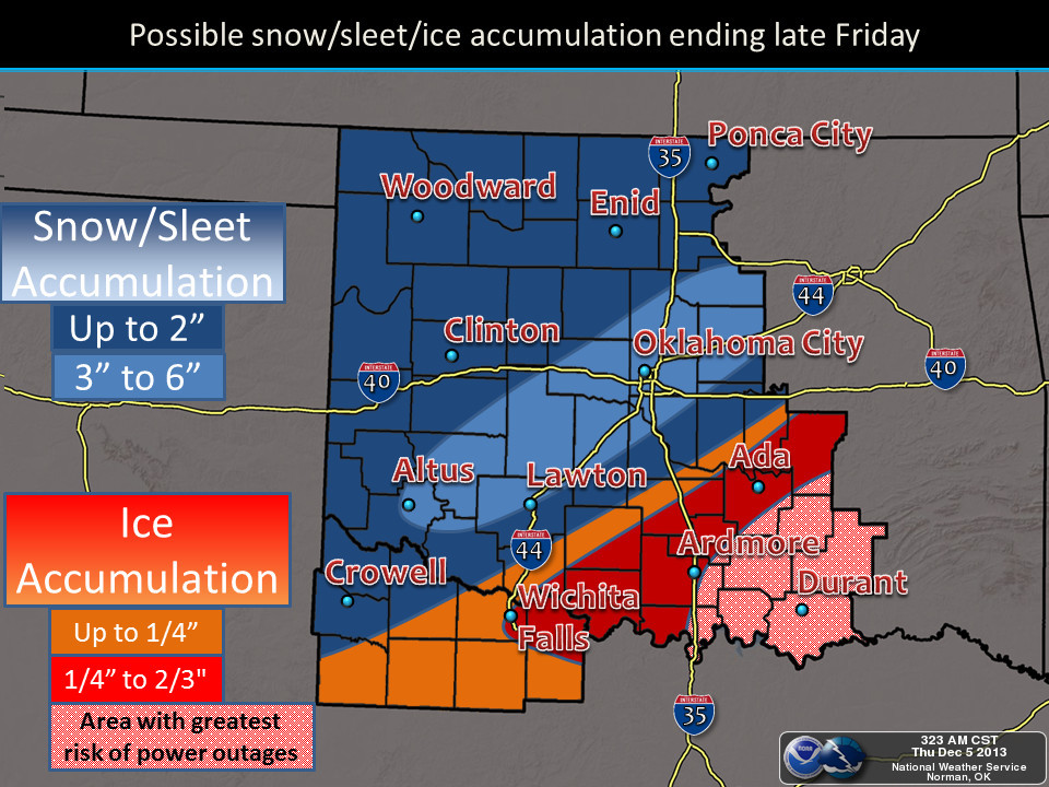 Winter Storm Cleon will not bring crippling amounts of moisture into most of Oklahoma- but still up to six inches of snow is possible in a band that runs along the I-44 cooridor before things wrap up on Saturday night or early Sunday morning. The map above shows what the National Weather Service in Norman is thinking in regards to precipitation totals for their forecast area. Freezing rain that could total a half inch or more is perhaps the biggest worry- and that will be happening in south central and southeastern Oklahoma- as well as south of the Red River into the Dallas- Fort Worth metroplex. Much of the frozen stuff of one sort or another will be coming in after dark Thursday through early Friday morning.
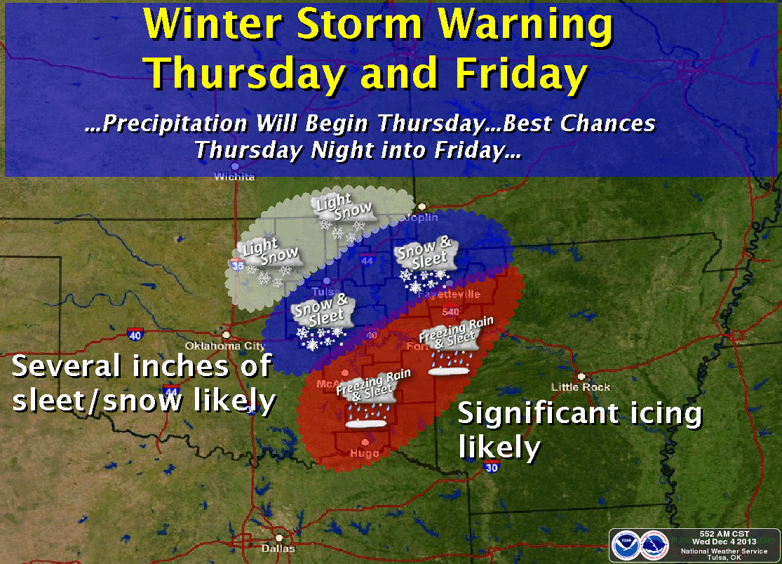
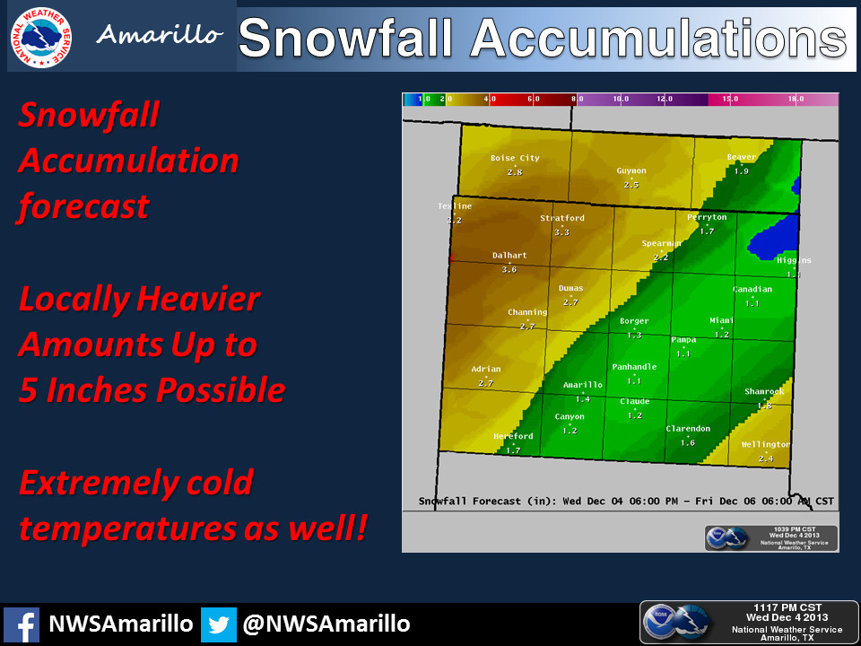
The maps below show the latest thinking from the National Weather Service offices in Tulsa and Amarillo. Extended forecasts into the middle of next week shows bitterly cold air both on Saturday morning of this coming weekend- and then again by Wednesday morning of next week.
About the temperatures- Alan Crone with the News on 6 writes "The temperatures will be frigid for a long duration possibly staying below freezing until Wednesday midday of next week. Readings are expected to remain in the 20s for today and Friday but morning lows Saturday should drop into the single digits. Afternoon highs this weekend will remain in the mid-20s. There's a chance the sky may clear out Monday and allow temps to drop back into the single digits for Tuesday morning. A prolonged period of sub-freezing temps can have big impacts on pipes, pets, and water supplies for cattle. Cranking amps in batteries along with tire air pressure can be affected by a long period of very cold air."
Click here for the full blog posted by Crone early this morning.
WebReadyTM Powered by WireReady® NSI
Top Agricultural News
More Headlines...


