


Agricultural News
Ugly Windchill Forecast for Thursday- The Latest Map
Wed, 22 Jan 2014 06:40:48 CST
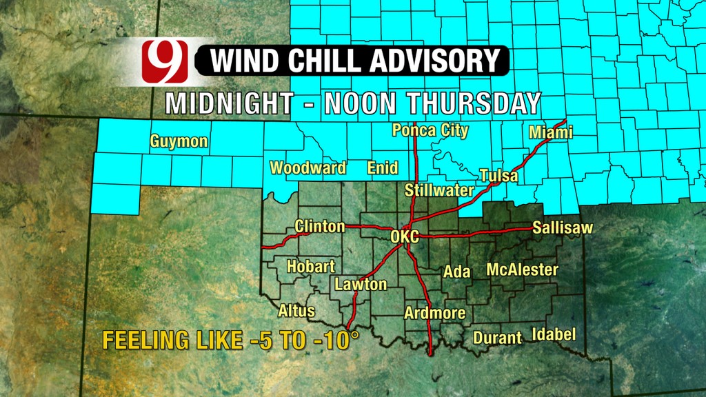 Colder air returns to Oklahoma for a short time before this weekend. The graphic above shows how cold things could feel Thursday morning.
According to Alan Crone with the News on 6- it will be a cold one- "A significant surge of cold air will arrive tonight knocking the temps back down into the cellar for Thursday and Friday. This arctic air mass will be short lived and a robust warm up is expected for the weekend with highs in the 50s Saturday and near 60 Sunday.
"Yesterday's air mass was colder by a few degrees with afternoon temps across some sections of NE OK only in the 20s. The south winds this morning have brought our temps into the lower 20s with some wind chill values in the teens. A boundary arrives with north winds during the next few hours but temps will move into the lower and mid-40s for afternoon highs along with sunshine until later this afternoon when some high and mid clouds will approach from the west. The colder air arrives later tonight and this will set the stage for a very cold 48 hour period. One of the issues we'll be watching closely will be the expected wind chill values for Thursday morning. Model projections support wind chills from 0 to -15 across the northern third of the state. These readings would require wind chill advisories for a few hours early Thursday morning. "
WebReadyTM Powered by WireReady® NSI
Top Agricultural News
More Headlines...


