


Agricultural News
Google Earth Simplifies Creation of Custom Maps
Wed, 05 Mar 2014 15:57:10 CST
Corey Moffet, assistant professor of agriculture at the Samuel Roberts Noble Foundation, writes in the latest Ag News and Views newsletter:
Most Americans today are just as likely to have a Global Positioning System (GPS) receiver on them as they are a flashlight, camera, calculator, entertainment center and even basic computing tools. That is, if they are carrying their smartphone. For millions of users, the smartphone has changed the way we do many things, including travel. Are you visiting an unfamiliar town? No problem. With an address and our smartphone, we are ready to tackle just about any navigational challenge. Type in the address, click route and we are on our way.
Not all parties will agree that our chosen path is the most direct or the quickest, but we eventually arrive at our destination. Want to share the location with someone? Just text them the address or open a map app to place a drop pin and share it.
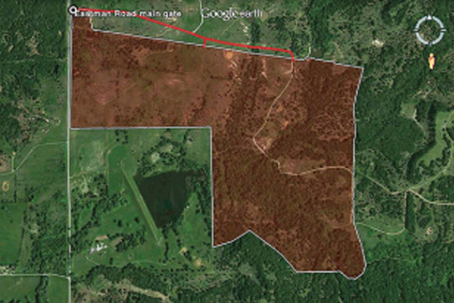
What about communicating more complicated spatial information than points or addresses? How about lines or areas? Maybe you want to share a path where you want a fence to be constructed with a fencing contractor. Maybe you want to show hunters the boundary of their hunting lease or someone wants to share a soils map with you. In these cases, addresses and drop pins just don't cut it, but we still don't have to drag out paper, pencil and a drafting table to communicate the information.
This is where Google Earth really helps. Google Earth is an application available for download at no cost on desktop. The mobile versions are best suited for viewing geographic features, whereas the desktop version is well suited to view, create and edit spatial features.
Even without the desktop version of Google Earth, you can view, create and edit spatial features on the Web using Google Maps or Bing Maps. Both services require you to sign in before you can edit spatial features such as points, lines or polygons. After signing in, click on "my places" to begin editing. When you are finished, you can export the layer as a kml or kmz file and send it as an email attachment. Opening the attachment on a phone or tablet with Google Earth installed will display the features on a map background. If the smartphone has a GPS, your location is also shown on the map.
You can load more sophisticated kml/kmz files as well, such as the publicly available SoilWeb file. The SoilWeb file will display a soil map for your currently displayed map. This data is the same as that in the SoilWeb app but it lets you see the soils of the surrounding area so that you can better understand how the soils are arranged on the landscape. Using kml/kmz files with Google Earth on a mobile device is a great way to communicate spatial information that goes far beyond an address or point.
WebReadyTM Powered by WireReady® NSI
Top Agricultural News
More Headlines...


