


Agricultural News
Drought Conditions Lessen Dramatically Across Oklahoma in Latest Monitor- the Latest Maps
Thu, 30 Apr 2015 20:59:43 CDT
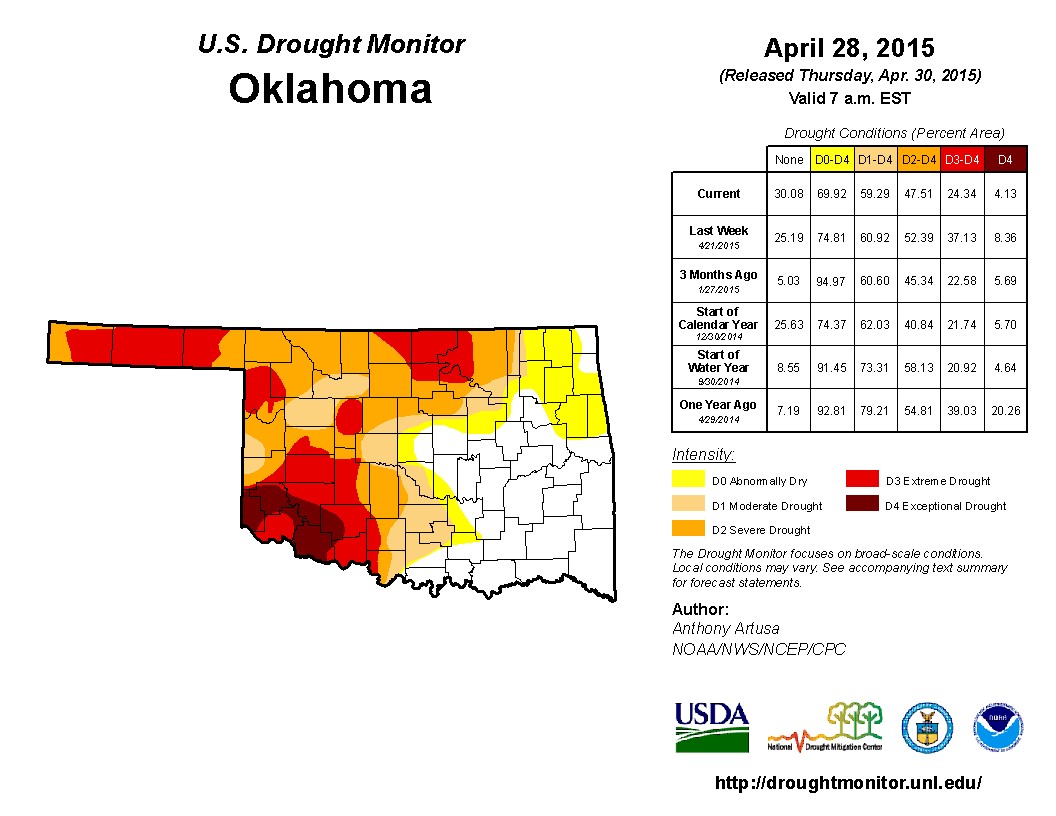 Rainfall arrived over the last thirty days- and in a dramatic swing, drought has been reduced in much of Oklahoma during the month of April because of that rainfall. The latest Drought Monitor is the graphic seen above- and looks much better than what was seen earlier in April. Overall, the total drought number of 59% of the state in some level of drought- moderate through exceptional is little changed from a week ago or even back to the start of the calendar year- but is twenty percentage points of an improvement compared to one year ago.
What has happened within the overall drought number is a substabtial easing of drought conditions in the last week. A week ago, the severe to exceptional drought number was just above 37%- this week that number has fallen to 24%.
The rainfall has helped winter wheat and canola as well as the permanent pastures. Pond water has improved- and several lakes have had some refilling- although lakes like Canton, Altis Lugert and Waurika have a long ways to go.
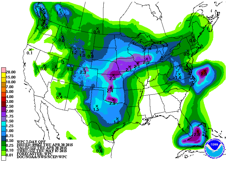
Looking ahead- it appears we have more rainfall in a system that show up in our state by the latter part of the weekend. Rainfall amounts north of two inches are possible in some areas of the state- see below.
Dick Faurot with the News on 6 writes a regular weather blog- and he expects wetness arrives in a few days- "We should stay dry through the weekend though, but that will be changing as we get into next week. The pattern aloft will become more favorable for the development of showers/storms and with abundant low level moisture available, next week looks to be very unsettled as you can see on our forecast page. The chances of showers/storms will be primarily west of us for the first of the week but gradually shifting more our way as the week wears on so the chances will also be increasing for the middle to latter part of the week.
"Not only does next week look to be unsettled, but looking at the precipitation expected on the 6-10 day outlook also has a strong signal suggesting above normal chances of showers/storms. Looking further down the road at the 8-14 day outlooks, there is also a strong signal suggesting above normal chances of showers/storms. Given the time of year, that also implies the possibility of severe storms."
With the News on 6 based in Tulsa- west would be central and western Oklahoma that he is referring to regarding rainfall early this coming week.
WebReadyTM Powered by WireReady® NSI
Top Agricultural News
More Headlines...


