

Agricultural News
Latest Drought Monitor Map Show Little Change From Previous Week
Thu, 12 Mar 2020 14:41:43 CDT
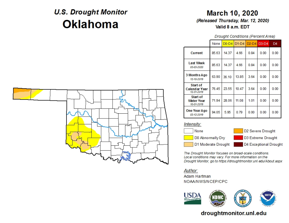 Taking a Look at The latest U.S. Drought Monitor Map released March 12 continues to show several areas of dry to moderate drought in the far western Oklahoma Panhandle and in the southwestern corner of the state. The good news is the pockets have not expanded from the previous week and after the forecast rains arrive over the areas Friday, the pockets could dramatically shrink.
We started 2020 with 23 percent of the state in the abnormally dry category (D0 to D3) and 10 percent in a moderate drought (D1 to D4). Today those numbers are 14 percent and 4 percent respectfully.
The worse drought in Oklahoma is D2- Severe Drought and it currently is found only in the northwestern tip of Cimarron County in the Oklahoma Panhandle. Abnormally dry to moderate drought is found in other areas of Cimarron and Texas Counties as well as in all or parts of 10 counties in southwest Oklahoma.
According to NOAA weather forecasters, during the next 5 days (March 12-16), low pressure will be moving into southern California and the Southwest, enhancing chances for precipitation in the Southwest and southern Great Plains.
The U.S. Drought Monitor Map is developed through a partnership between the National Drought Mitigation Center at the University of Nebraska-Lincoln, the United States Department of Agriculture, and the National Oceanic and Atmospheric Administration.
To study current drought ratings in further depth for the state- click or tap here.
WebReadyTM Powered by WireReady® NSI
Top Agricultural News
More Headlines...


