

Agricultural News
Latest Drought Monitor Map shows Improvement, But Some Dry Areas remain in Panhandle and SW Oklahoma
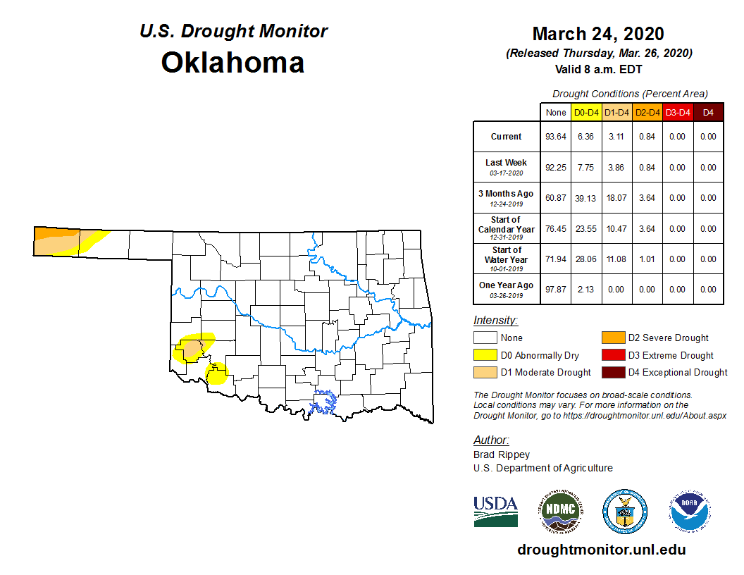
Thu, 26 Mar 2020 19:09:40 CDTThe latest drought monitor map released March 26 still shows a small section of the far western Oklahoma Panhandle and a small area in southwest Oklahoma continuing to need a good drink of water.
The dry areas in southwest Oklahoma that we have been watching did not shrink as much as expected given the recent storms. Tillman County saw some improvement, moving from a small patch of moderate drought (D1) to abnormally dry (D0). Much of Greer County continues to show D0 to D1, centered on Mangum. The abnormally dry area overlaps the edges of Kiowa and Jackson Counties.
Statewide today, the overall improvement is noticeable as we see about 6 percent of the state in the abnormally dry area, an improvement from almost 8 percent last week. The worse drought in Oklahoma is D2- Severe Drought and it currently is found only in the northwestern tip of Cimarron County and accounts for less than one percent of the state's total land area, the same percentage as last week.
Sadly, those driest areas will not receive much help in the coming days as the NOAA weather precipitation forecast map shows little to no additional moisture.
The U.S. Drought Monitor Map is developed through a partnership between the National Drought Mitigation Center at the University of Nebraska-Lincoln, the United States Department of Agriculture, and the National Oceanic and Atmospheric Administration.
To study current drought ratings in further depth for the state- click or tap here.
WebReadyTM Powered by WireReady®NSI
Top Agricultural News
More Headlines...


