Agricultural News
Latest U.S. Drought Monitor Map Shows Shifting Weather Pattern Greatly Reduced Drought Conditions For Oklahoma
Thu, 06 Aug 2020 14:10:50 CDT
 Incredible is one of the many words being used this week to describe the recent wet, cool weather that has descended upon Oklahoma and surrounding areas.
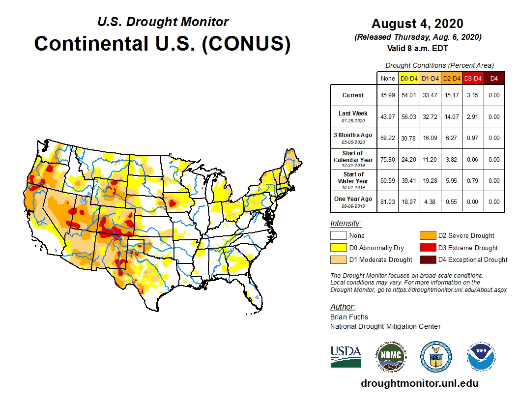
Thanks to tropical storm Isaias and a rerouted jet stream, above normal precipitation and temperatures 2-8 degrees cooler than normal reduced drought conditions throughout many areas in Kansas, Oklahoma, Arkansas and northern Texas.
Almost a full category improvement was made from central Oklahoma into northwest Arkansas. Areas of southeast Texas were improved with both abnormally dry and moderate drought reduced.
However, areas of central and west Texas saw the drought worsen and expand.
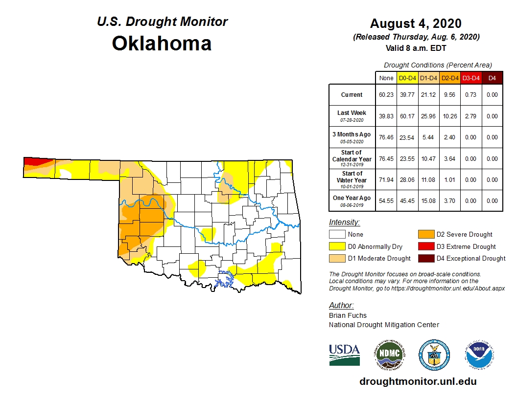
Specifically, for Oklahoma, more than 60 percent of the state is free of any drought conditions this week, a major change from last week's 39.8 percent figure.
Extreme drought (D3) has been reduced to a stubborn pocket in Cimarron County.
The Mesonet rainfall maps tell the story, especially over the last 30 days. Click here to view the maps.
There are still areas of moderate to severe drought in the Oklahoma Panhandle, western and northeastern Oklahoma.
To view the Oklahoma drought monitor map update, click here.
To view the U.S. Drought Monitor map, click here.
Looking ahead a return to more summer like conditions are expected with hot, mostly dry conditions for much of the region.
To view the August monthly drought outlook map, click here.
The U.S. Drought Monitor Map is developed through a partnership between the National Drought Mitigation Center at the University of Nebraska-Lincoln, the United States Department of Agriculture, and the National Oceanic and Atmospheric Administration.

WebReadyTM Powered by WireReady® NSI
Top Agricultural News
More Headlines...


