

Agricultural News
Latest U.S. Drought Monitor Map Shows Drought Conditions Increasing For The Far West, Southwest, Parts of Oklahoma And Iowa
Thu, 27 Aug 2020 09:08:37 CDT
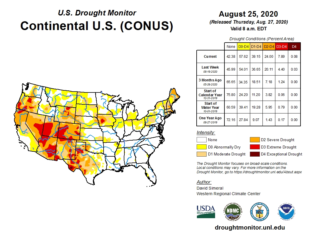
 Extensive areas of red (D3 Extreme) and dark red (D4 Exceptional) shades of drought are now covering many regions of the west, southwest and central Rocky Mountains, according to the latest U.S. Drought Monitor map.
On this week's map drought intensified due to continued hot temperatures and mounting precipitation deficits.
The tropical storms and hurricanes moving in off the Gulf Coast this week will have little impact on much of the seriously dry regions of the country.
There is growing concern for dryness and extreme drought in Iowa, a traditional strong area for corn and soybean production. The dryness has extended this week to the northern High Plains and along the northern corn belt.
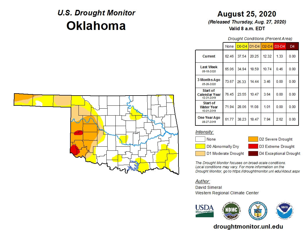
For Oklahoma the extreme drought concerns have shifted from the Panhandle to the southwest where 4-to-6-inch rainfall deficits since June 1 exist.
Most of Harmon County and parts of Jackson, Greer, Beckham and Roger Mills Counties are colored with shades of extreme drought this week.
Statewide, 62.46 percent of Oklahoma has no drought concerns. Last week that number was 65 percent, so drought concerns have increased in coverage by almost 3 percent.
Extreme drought designation has increased slightly from .46 percent to 1.33 percent.
Looking ahead, there could be some slight relief as the calendar turns over into September as the chances for precipitation and cooler weather increase for Oklahoma.
Unfortunately, the extremely dry regions out west will see no relief anytime soon.
Click here for the 6-10-day temperature forecast.
Click here for the 6-10-day precipitation forecast.
Click here to view the Oklahoma drought map update.
Click here to view the U.S. drought map update.
The U.S. Drought Monitor Map is developed through a partnership between the National Drought Mitigation Center at the University of Nebraska-Lincoln, the United States Department of Agriculture, and the National Oceanic and Atmospheric Administration.
WebReadyTM Powered by WireReady® NSI
Top Agricultural News
More Headlines...


