

Agricultural News
Drought Worsens Across The Region Causing Major Concerns For Farmers Planting Winter Wheat
Thu, 01 Oct 2020 15:19:47 CDT
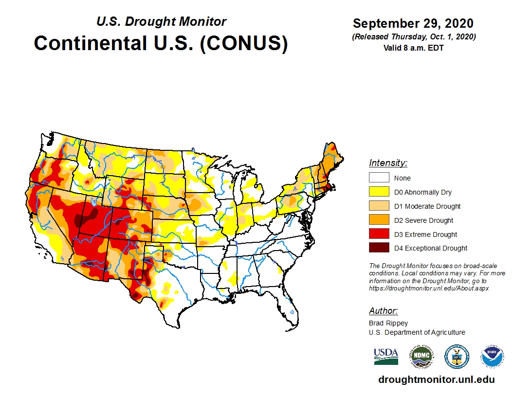
 Conditions have rapidly worsened across the High Plains areas of Texas and Oklahoma during the past week as indicated in the latest U.S. Drought Monitor update.
This is especially troublesome as winter wheat producers are anxious to plant their crops but now must decide to either wait for more moisture or plant into dust. The planting window is narrowing as we enter October.
Two new areas of exceptional drought (D4) have popped up in western Texas. Midland, Texas has received less than 7 inches so far this year, about 60 percent of normal precipitation.
In the northern Texas Panhandle, year-to-date precipitation has yet to reach 9 inches.
The dry conditions are showing up in the fields as Texas leads the nation with the largest amount (35 percent) in the poor to very poor category.
Oklahoma has the largest amount (47 percent) of grain sorghum in the poor to very category.
Almost all the western states are covered in some shade of drought with Utah and Arizona mostly covered in red (D3 extreme drought) and dark red (D4 exceptional drought).
California, Colorado, New Mexico, Nevada and Oregon are also covered up in shades of drought.
To view the current U.S. drought monitor map, click here.
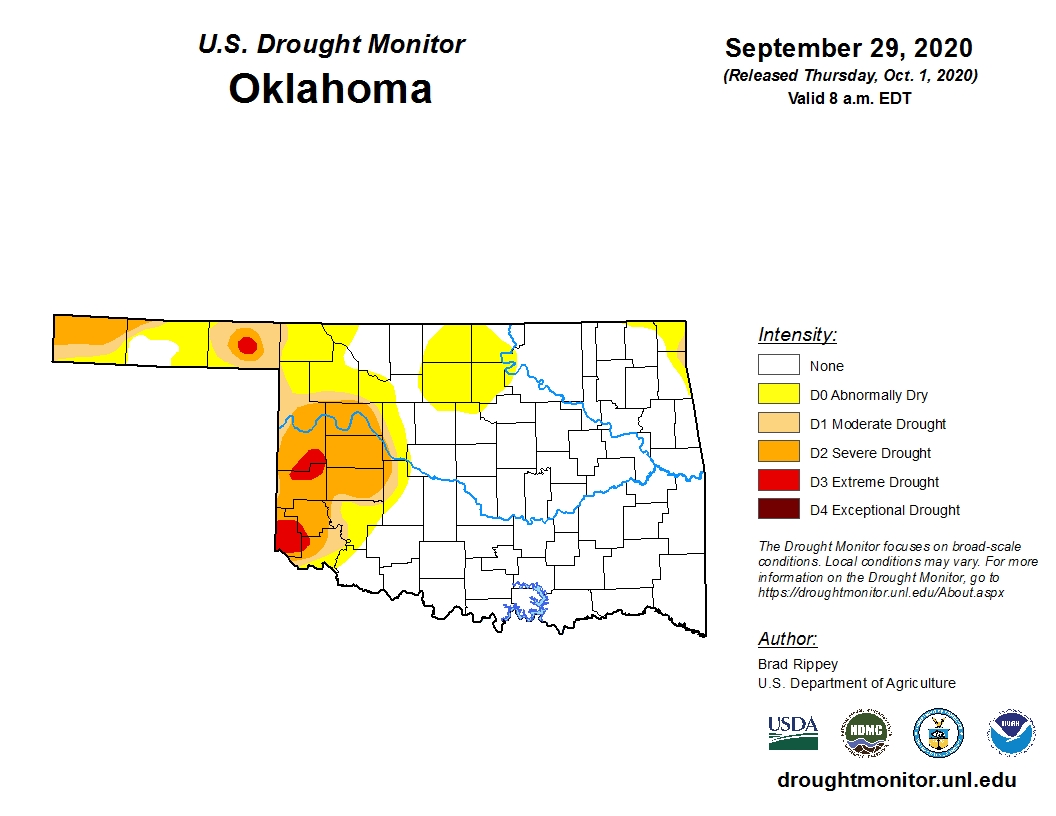
Specifically, for Oklahoma, the amount of D3 (extreme drought) has increased by more than 50 percent during the past week.
Beaver County, in the Oklahoma Panhandle, now has a red "bullseye" of extreme drought surrounded by circles of severe and moderate drought.
To view the current Oklahoma drought monitor map, click here.
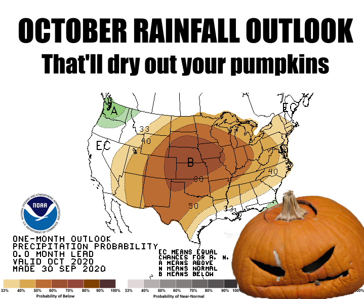
Unfortunately, the outlook does not bode well for much of the central and western United States.
With credit to the Oklahoma Mesonet staff, click here for a not-so-humorous graphic for the 30-day precipitation outlook.
To view the latest monthly drought outlook map for October, click here.
To view the 6-10-day temperature outlook, click here.
To view the 6-10-day precipitation outlook, click here.
The U.S. Drought Monitor Map is developed through a partnership between the National Drought Mitigation Center at the University of Nebraska-Lincoln, the United States Department of Agriculture, and the National Oceanic and Atmospheric Administration.
WebReadyTM Powered by WireReady® NSI
Top Agricultural News
More Headlines...


