

Agricultural News
Red Flag Fire Warning Continue Across the State This Week with Few Rain Chances
Mon, 28 Mar 2022 15:21:32 CDT
 On the heels of increasing initial attack activity late week and through the weekend along with an increase in both prescribed fire and controlled burning activity, fire danger will build both Monday and Tuesday in western Oklahoma while moderating a bit in the east where rather heavy wildfire activity has occurred in recent days. A Red Flag Warning is in effect today for Cimarron County from Noon until 9:00 PM and a Fire Weather Watch is in effect for Tuesday across much of western Oklahoma. OFS will be positioning resources today in both Weatherford and Lawton with adjustments on Tuesday likely as the fire environment potential for significant fire occurrence favors northwestern Oklahoma.
Today: Fire weather attention is drawn to the Red Flag Warning in Cimarron County although accelerated drying across the state and amount of fire on the landscape east will result in persistent fire activity across Oklahoma today. With temperatures above normal , relative humidity values this afternoon will range from 5% in Cimarron County to the mid-30%'s in southeastern Oklahoma as south winds return. Initial attack activity will remain likely with continued large fire emergence across the state.
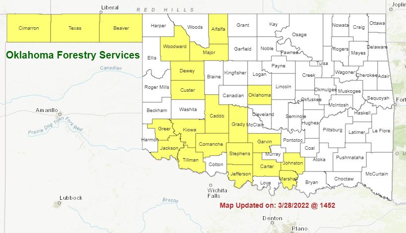
• Warned Area/Oklahoma Panhandle:
In Cimarron County, and across the Oklahoma Panhandle, temperatures will warm into the 80°-86° range under mostly-clear skies with afternoon relative humidity values 5-20%. Fine-dead fuel moisture values will range from 2% in Cimarron County to 4% further east in Beaver County. Light and variable winds this morning will become southerly sustained 13-21 mph this afternoon with gusts around 25 mph especially in the western Panhandle. Rangeland fuels in the area will support rapid rates of fire spread 183-253 ft/min (+/- 2.4 mph) with head fire flame lengths 12-14 ft. Windspeeds do moderate overnight although moisture recover will be very slow to respond supporting active burning conditions well into the nighttime period.
• Central/Eastern Oklahoma:
Fine-dead fuel moisture values will not dip as low as was observed yesterday although the amount of fire on the landscape coupled with accelerated drying over the weekend will hold the expectation for persistent wildfire activity in place today. Marginal overnight moisture recovery will result in fuel availability early in the burning period today as temperatures warm into the upper-70°'s to mid-80°'s. Afternoon relative humidity values will not be as low as yesterday reaching 29-35% this afternoon with fine-dead fuel moisture values 5-6%. East winds this morning are forecasted to become southerly this afternoon sustained 9-14 mph with some higher gusts. Grass-dominated fuels will exhibit head fire rates of spread this afternoon 93-149 ft/min with flame lengths around 11 ft. Timber fuels will exhibit variable fire behavior with hardwoods exhibiting ROS around 20 ft/min while pine dominated fuels will exhibit ROS 45-64 ft/min with continued problematic fire behavior including torching and spotting.
• Western Oklahoma:
Energy Release Component values remain above the 70th percentile across the area with some locations trending higher equating to an expectation of enhanced resistance to control. Temperatures will range from the upper-70°'s north to 88° south with afternoon relative humidity values 18-26% yielding fine-dead fuel moisture values at 4% across most of the area with some 3% observations likely. Variable winds this morning will become southerly this afternoon sustained 9-18 mph with some gusts above 25 mph. Rangeland fuels will exhibit head fire rates of spread 120- 216 ft/min with flame lengths 10-14 ft. Marginal overnight moisture recovery and persistent winds will result in an extended burning period into the nighttime hours.
Tuesday:
Tuesday is set to be a dynamic weather day in Oklahoma. Fire danger concern builds as a dryline pushes into western Oklahoma driving potential for extreme fire danger coupled with an approaching cold front in the overnight hours. Current forecast places emphasis in northwestern Oklahoma, west-central Oklahoma and the eastern half of the Oklahoma Panhandle. In this area, temperatures in the 80°'s and relative humidity values below 20% carrier fuels will be very receptive. The strength of the winds will challenge electrical infrastructure and promote rapid to extreme rates of fire spread on any established wildfire. Rangeland fuels will have potential to exhibit head fire rates if spread in excess of 350 ft/min or +3.5 mph. The extent of the area of highest concern tomorrow will be dependent upon a handful of fire weather inputs including: 1) eastern extent of the dryline, sky cover, and strength of the wind field. Nonetheless, a concerning fire danger day in western Oklahoma.
Near-Term:
Given current forecast inputs, fire danger is expected to wain behind a cold front entering the state overnight on Tuesday. Current Quantitative Precipitation Forecast hints at wetting amounts along and east of I-35 with variable amounts west. Temperatures dip below normal on Wednesday before returning to a normal range later in the week encouraging continued green-up in areas dominated by cool-season grasses and forbs. Another rain opportunity develops at the end of the week.
Burn Bans--Click here to see the latest activity.
WebReadyTM Powered by WireReady® NSI
Top Agricultural News
More Headlines...


