


Agricultural News
Rainfall Headed For Oklahoma- Helping End the Summer of 2013- The Latest Maps
Thu, 19 Sep 2013 05:56:38 CDT
 Rainfall and cooler weather are headed into Oklahoma to wrap up the 2013 summer season. While the Panhandle may be looking at thirty to forty percent chances of rain today- with the rain likely to be done by this evening in those three counties- the body of the state will see the rain move in late Thursday afternoon and into the nighttime hours- continuing into Friday morning in eastern counties.
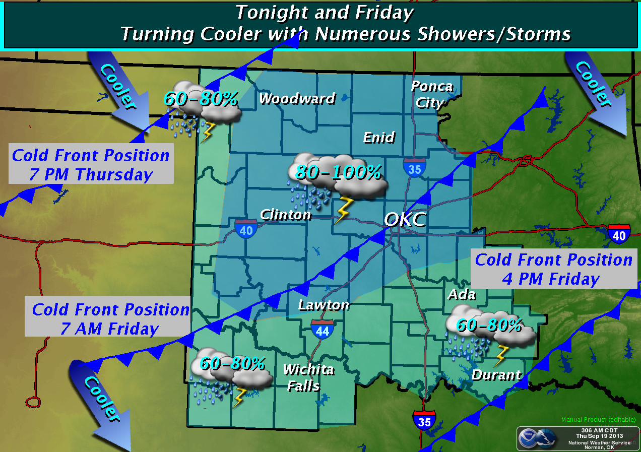
As you can see from the forecast map above- rain chances in the body of the state range from sixty to one hundred percent Thursday into Friday. While the map does not show eastern Oklahoma rainfall chances- the chances are similar to that seen in central counties of the state.
According to the National Weather Service, a cold front will move into northwest Oklahoma late this afternoon and move southward through the remainder of Oklahoma and north Texas Tonight and Friday. Numerous showers and thunderstorms are expected as the front moves through. Cooler temperatures will occur areawide Friday. Dry and mild weather is expected for the weekend- which is the start of Fall 2013.
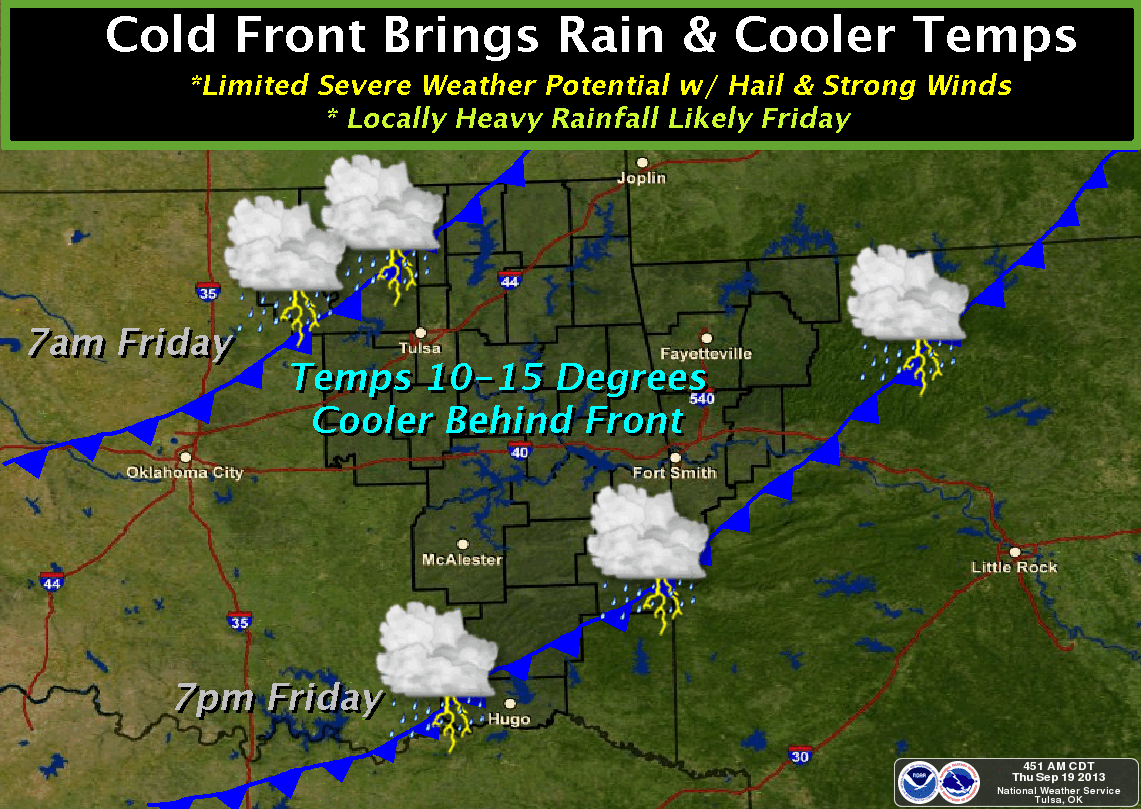
The weather map below shows the movement of the front on Friday into eastern and southeastern Oklahoma. Rainfall chances in McAlester, for example, stand at 60% for this evening and up to 80% during the day on Friday.
WebReadyTM Powered by WireReady® NSI
Top Agricultural News
More Headlines...


